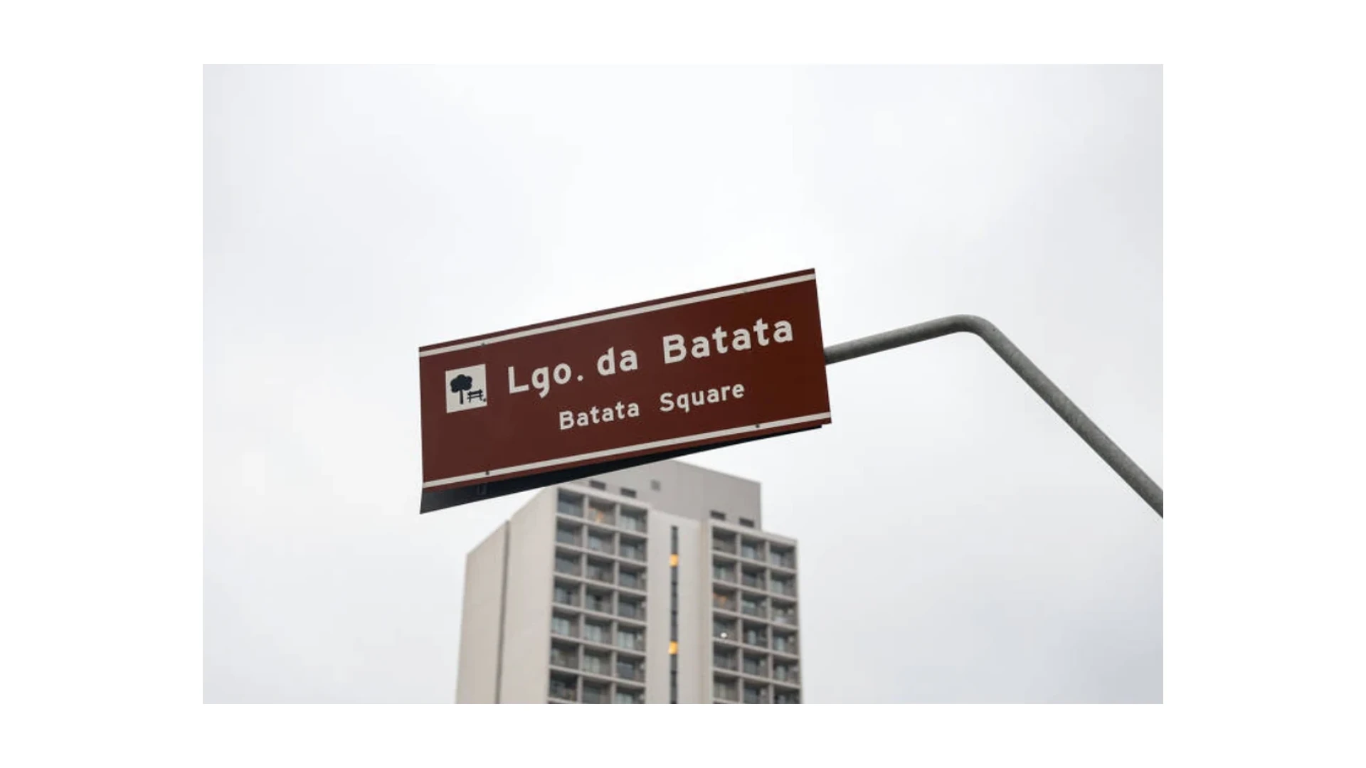

Largo da Batata

Largo da Batata
Developer
Private
Program
Masterplan
Location
São Paulo, SP, Brazil
Status
Concept design
Year
2023

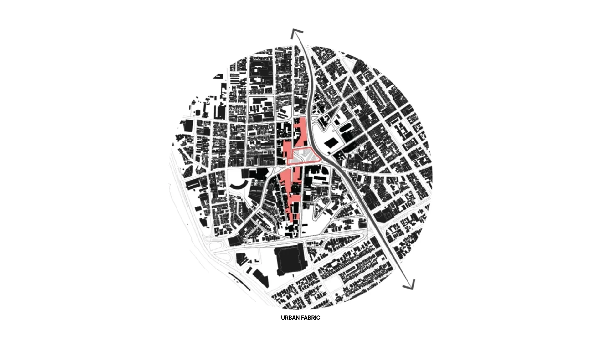
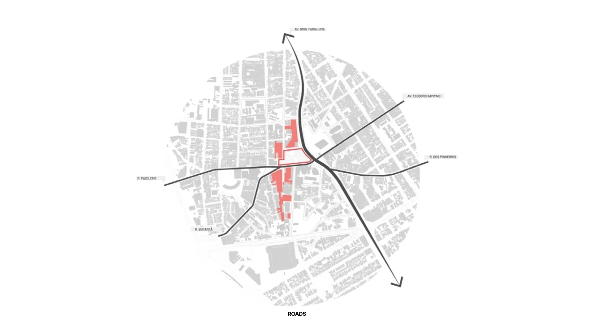
In the 1950s and 1960s, Largo da Batata saw the construction of one of São Paulo's main roads, Avenida Brigadeiro Faria Lima, which cut across the region. This brought a significant change to the landscape and dynamics of the square, making it an important crossing and transport point in the city.

In recent decades, Largo da Batata went through a revitalization process that the local population and its regular visitors did not fully embrace. At the same time, from Avenida Brigadeiro Faria Lima onward, the territory is shaped by a more corporate morphological and economic trend and by a more popular cultural permanence, making this space a unique cultural and economic melting pot in the city of São Paulo.

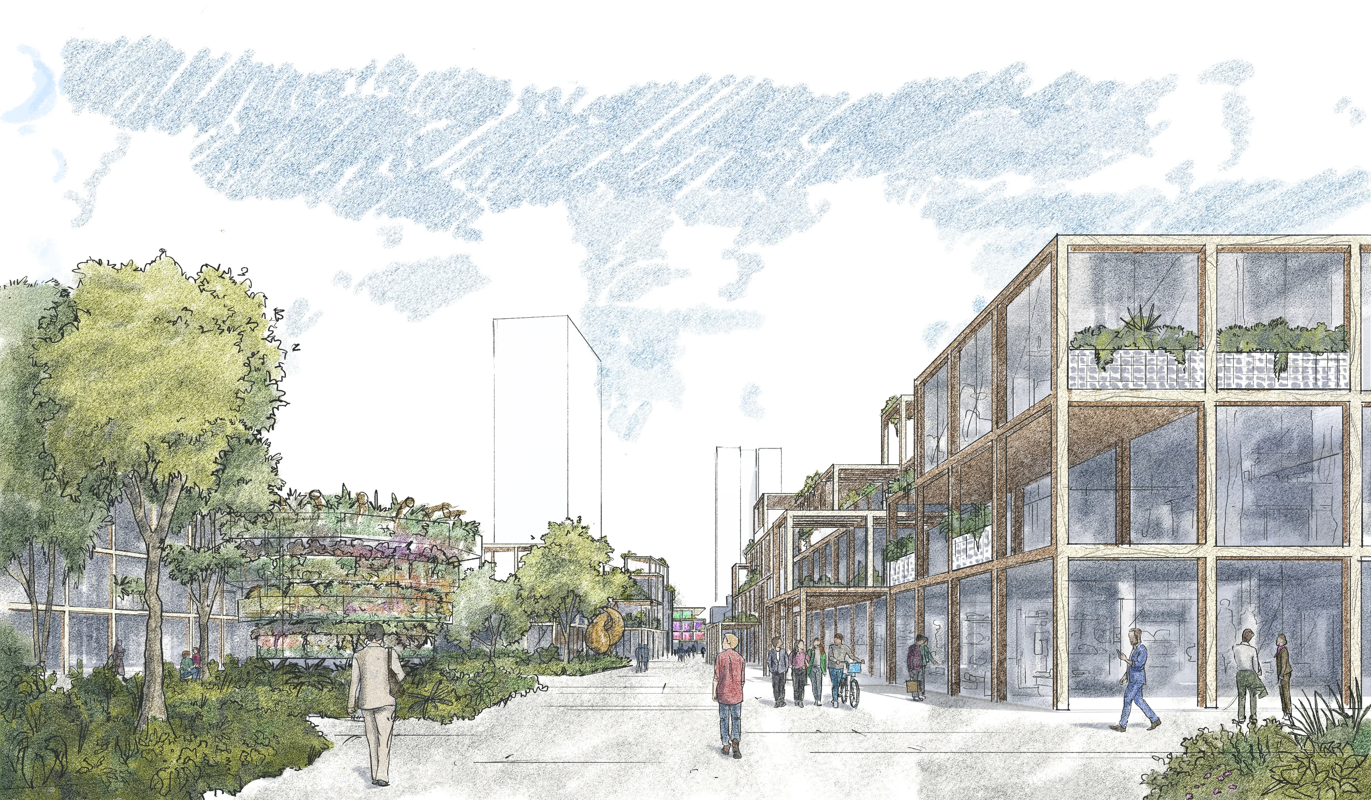
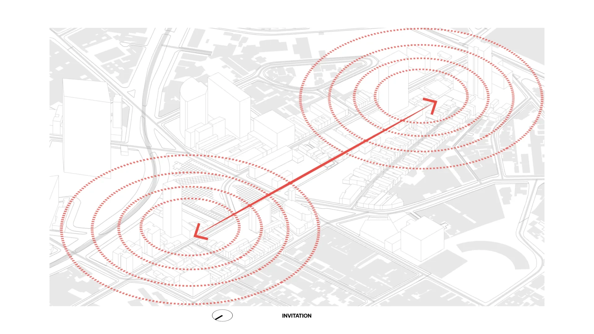
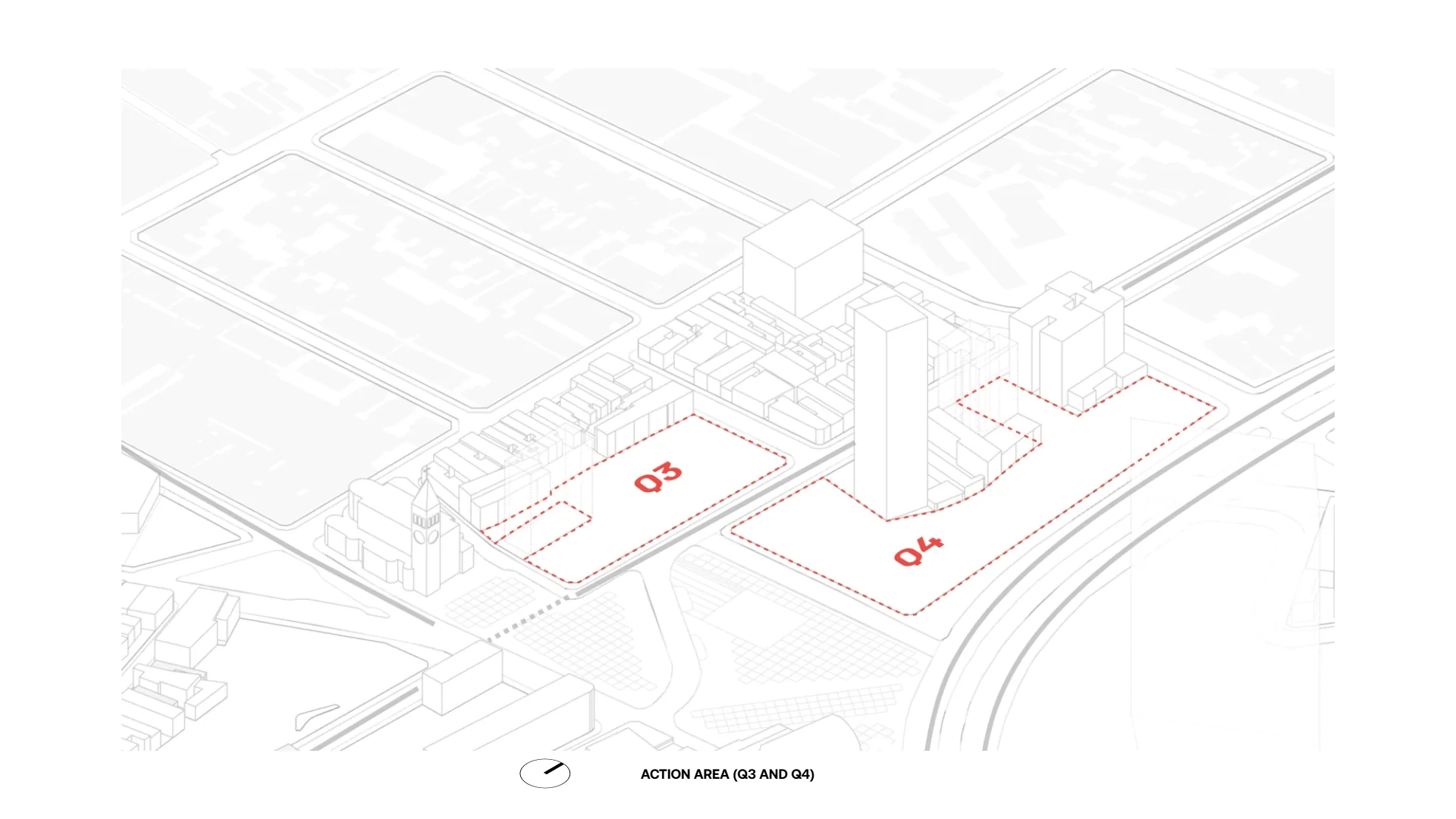
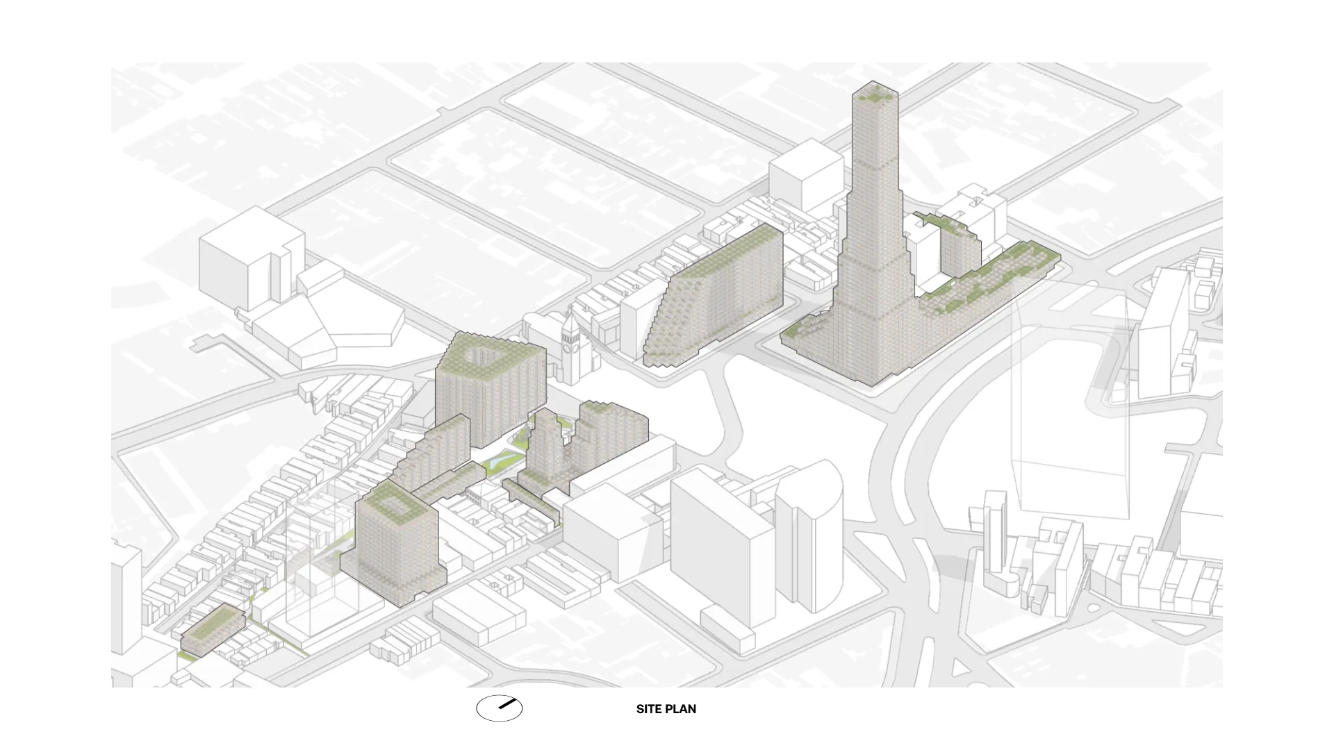
Through an integrated approach, Instituto Cidades Responsivas identifies the potential of the territory and defines its vocation through the Strategic Urban Planning Consultancy, and OSPA Architecture translates this vision into an urban masterplan that builds a dialogue between memory and transformation, preserving the historical resonances of the place and driving a new urban centrality in São Paulo.

the [new]context

“I wouldn't live near Faria Lima, because it is a place that reminds me of aridity, besides being hardly walkable compared to the rest of the city.”

“The way the area was sealed with paving was aggressive.”

“Part of the commerce that existed there no longer exists… two blocks were expropriated. There was a street market there that became all avenue. It is a very arid place, with less diversity and few trees.”

“I walked around the region a few years ago to get to know the bars. I remember it being an arid space, close to the subway.”

Behavioral research with focus groups prepared by Instituto Cidades Responsivas

Discover the strategic urbanism consultancy

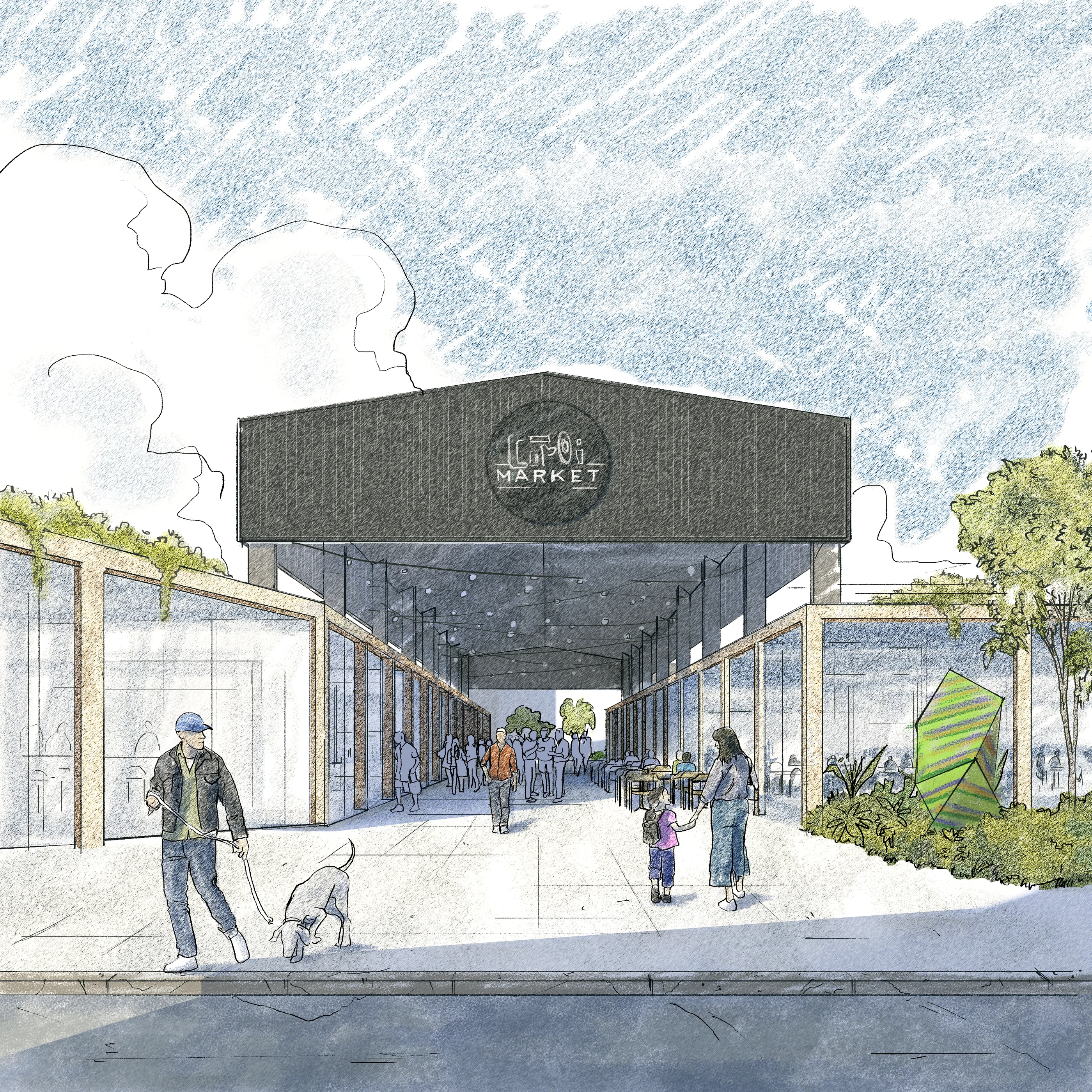
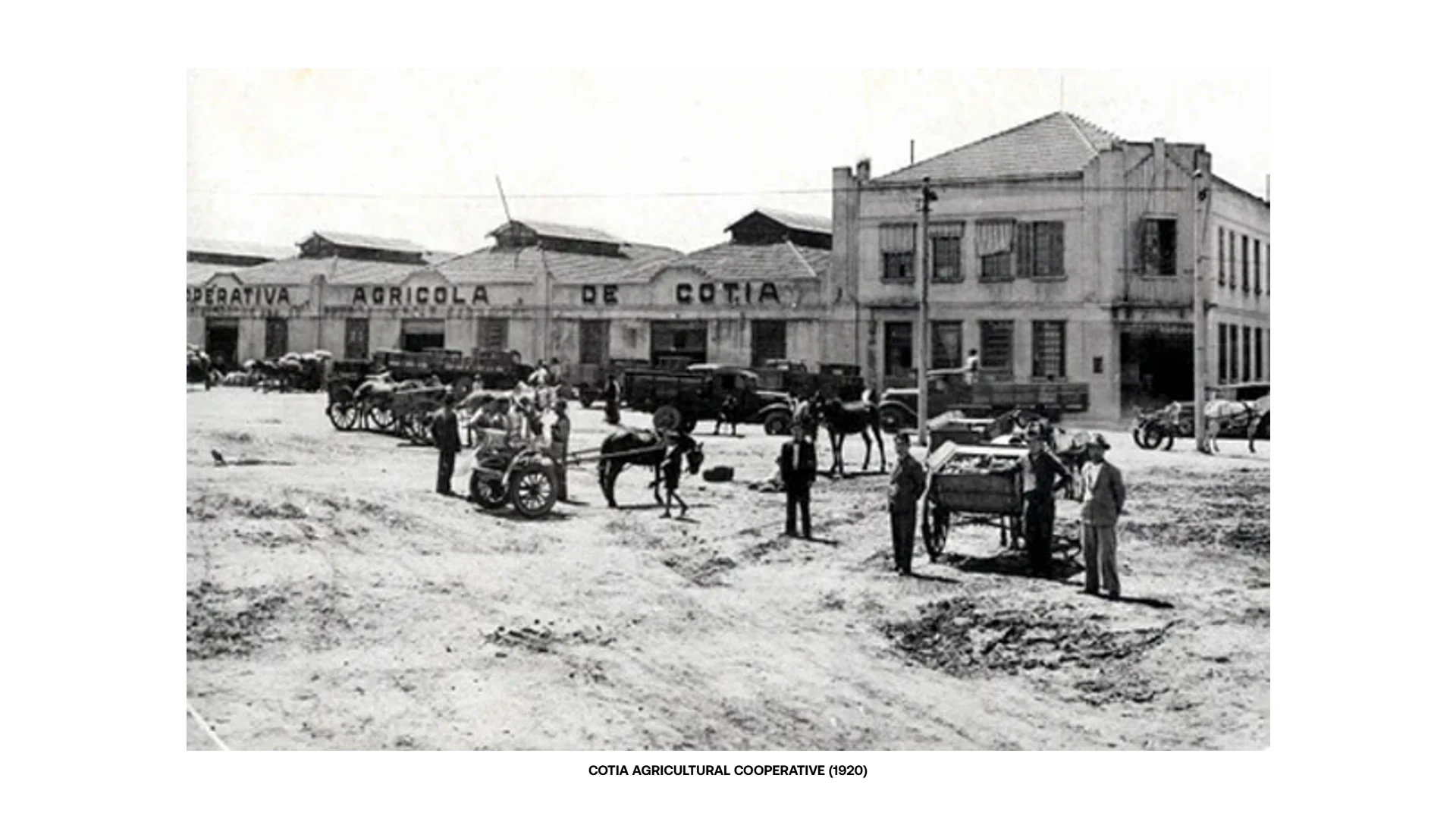
The Cooperativa Agrícola de Cotia was the organization that occupied the Largo da Batata area and gave the place its name. Established by Japanese and Japanese-Brazilian merchants, the cooperative began to occupy the space after wholesale products were banned at the Pinheiros Market (Mercado dos Caipiras), which scattered the merchants across the neighborhood, with the Largo da Batata area becoming the busiest one.

Source: saopaulo.com.br

1 / 6

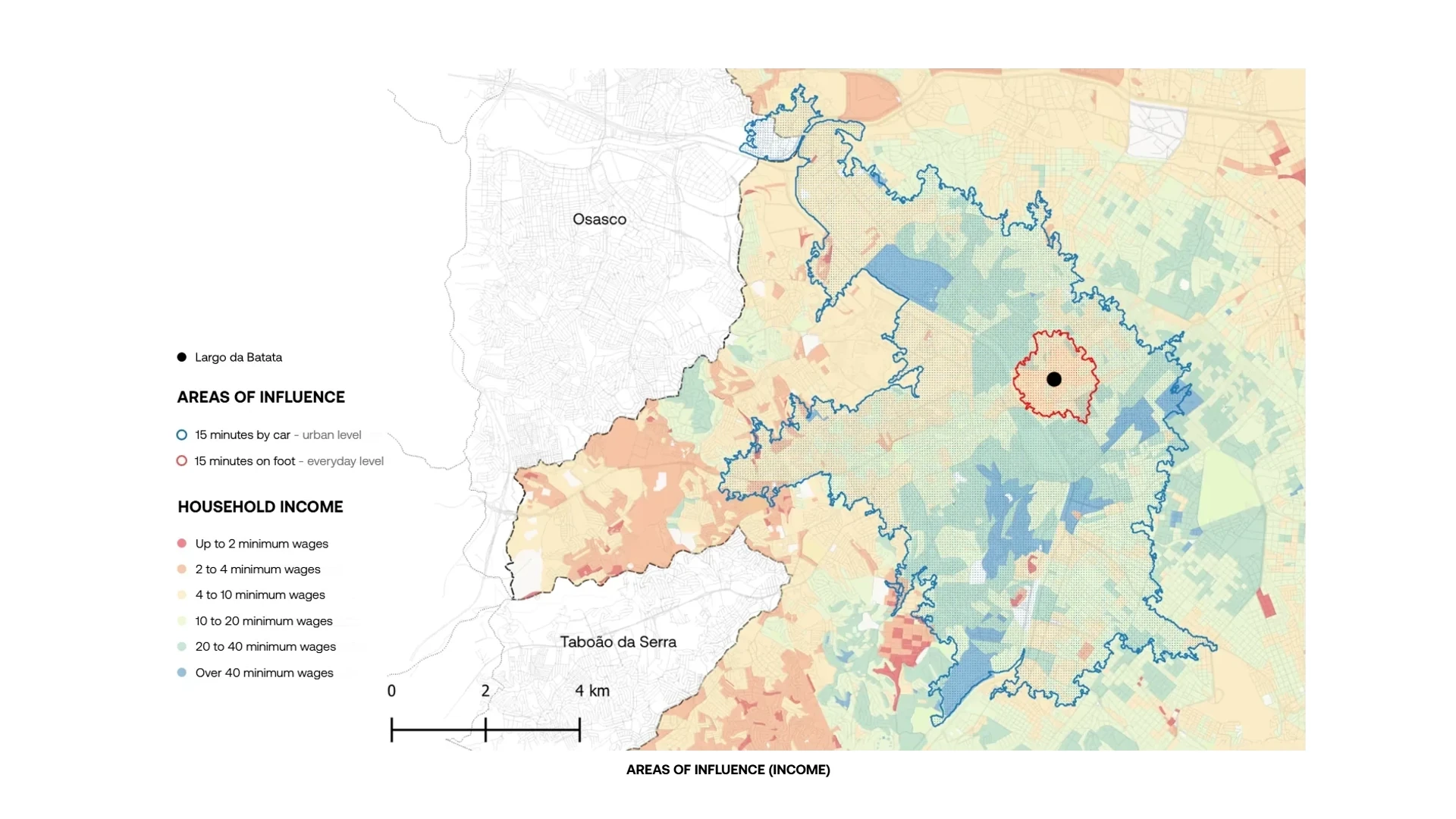
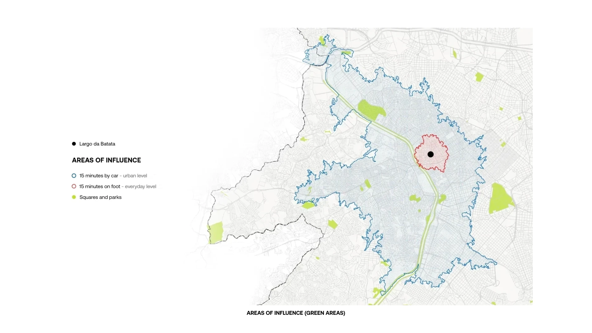
“The absence of green areas within the everyday area of influence confirms the empirical perception of the region's regular visitors and, when used to justify a lack of interest in living there, reveals a crucial transforming agent to be addressed in the regeneration of the space.”

Instituto Cidades Responsivas
buildingon what is built

(Re)building a city's symbolic landmark is a task that demands care. Largo da Batata is one of the spaces rooted in the imagination of São Paulo residents, a place of affection for a large part of the population. Balancing the forces between caring for its memory and projecting its future is a must for the best development and acceptance of the new place.

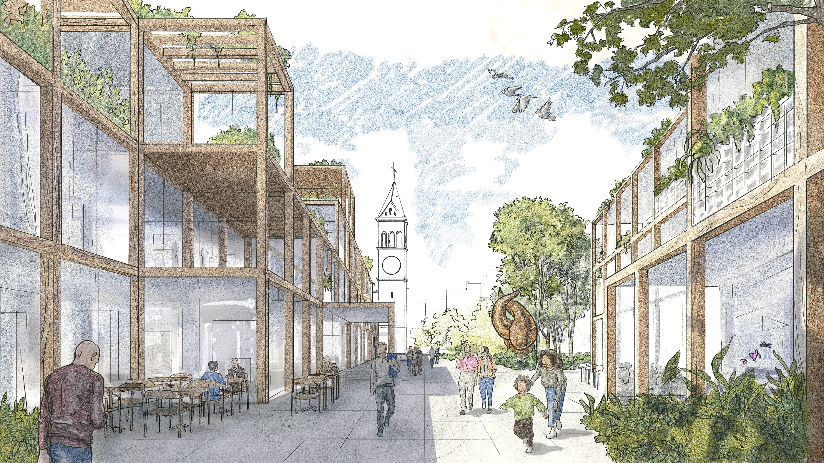
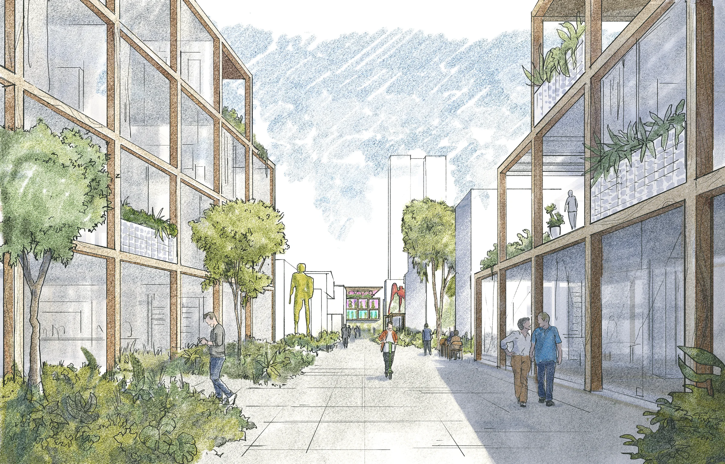
(Also) It is through its streets that the city makes contact and talks with its user. The perception of a space's value is invariably tied to how it relates to the streets that run through it. Reconciling pedestrians with the region is necessary, and through it a place of passage should be reconfigured as a place of permanence.
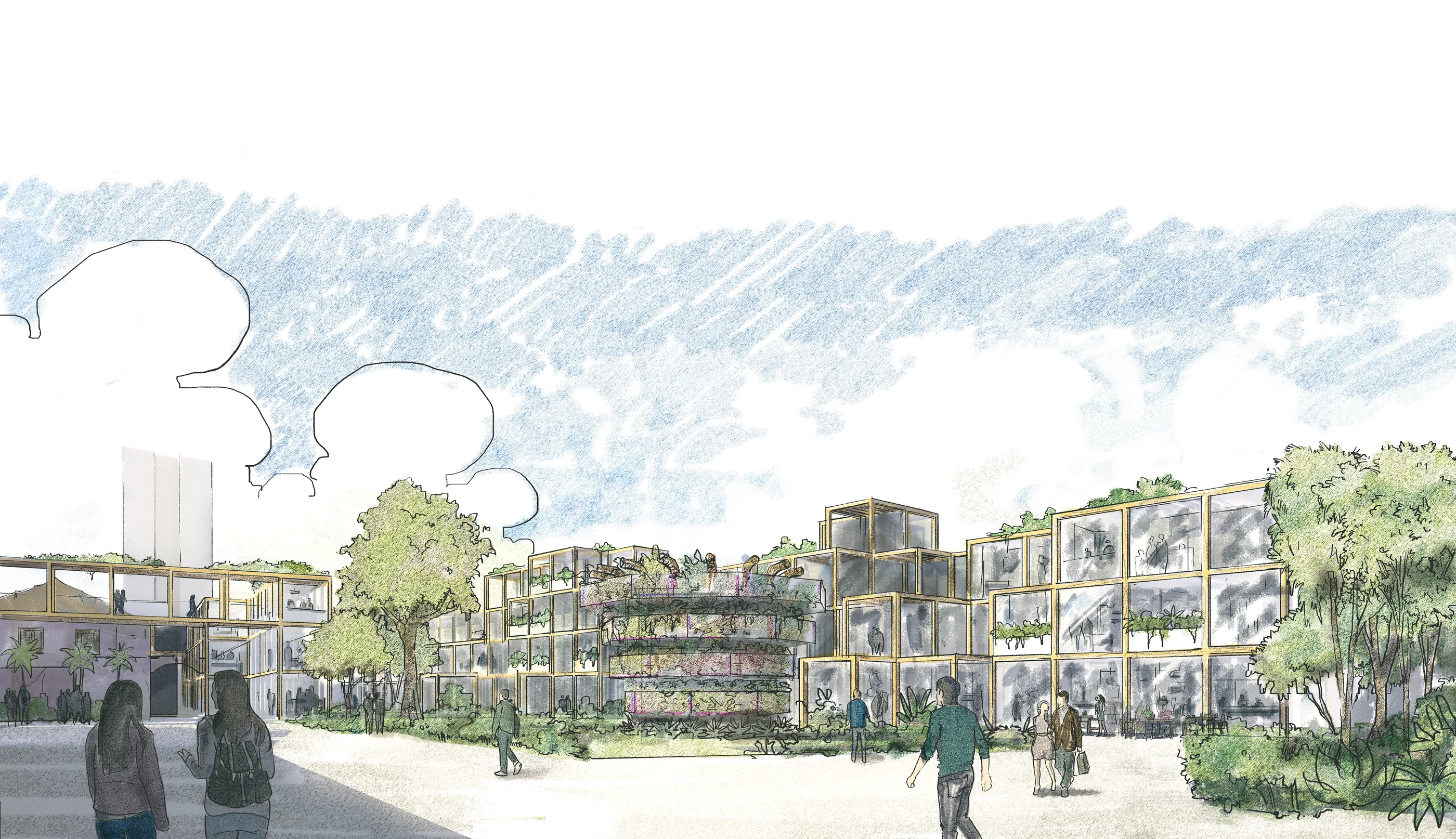
Placemaking

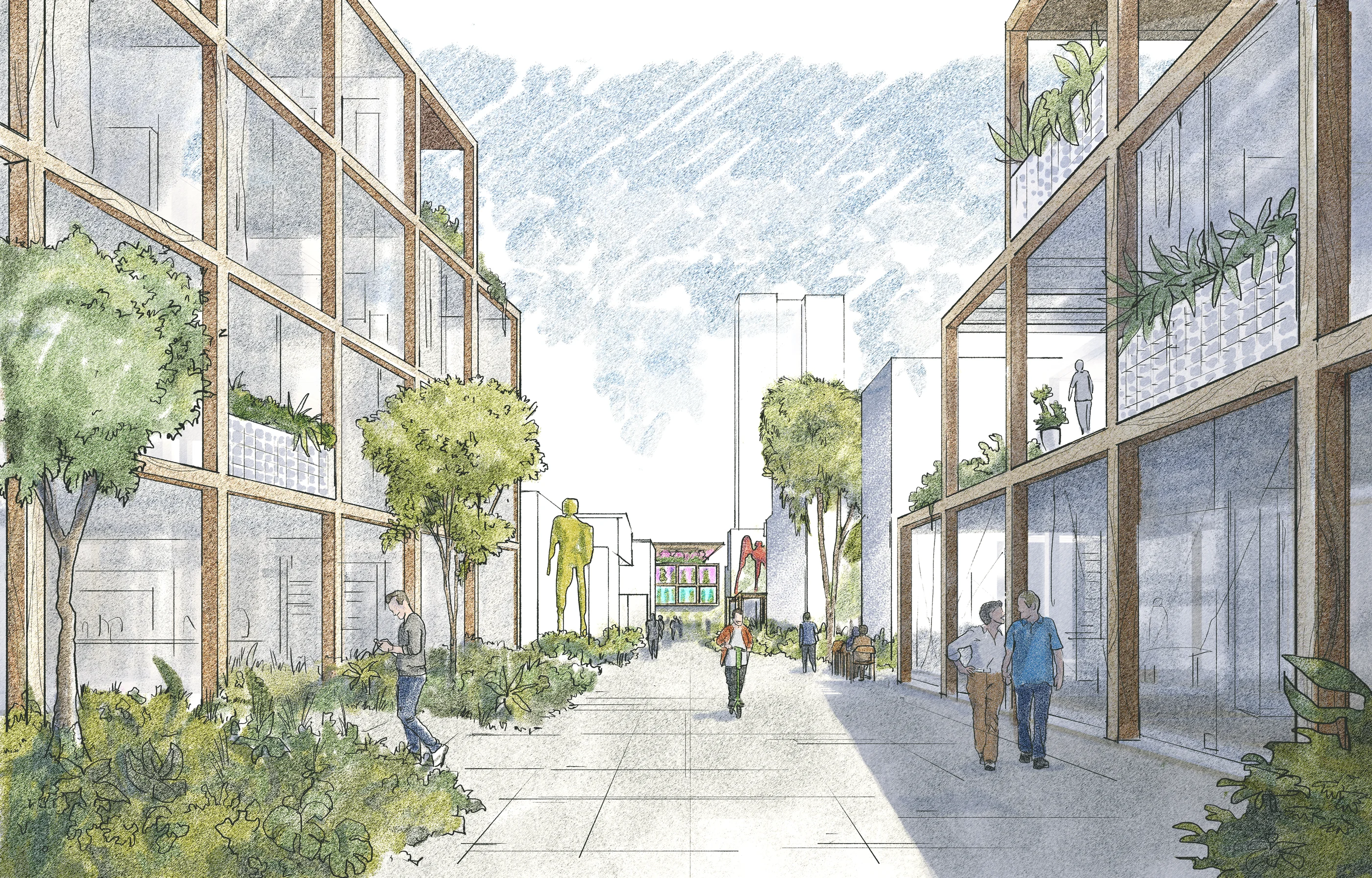
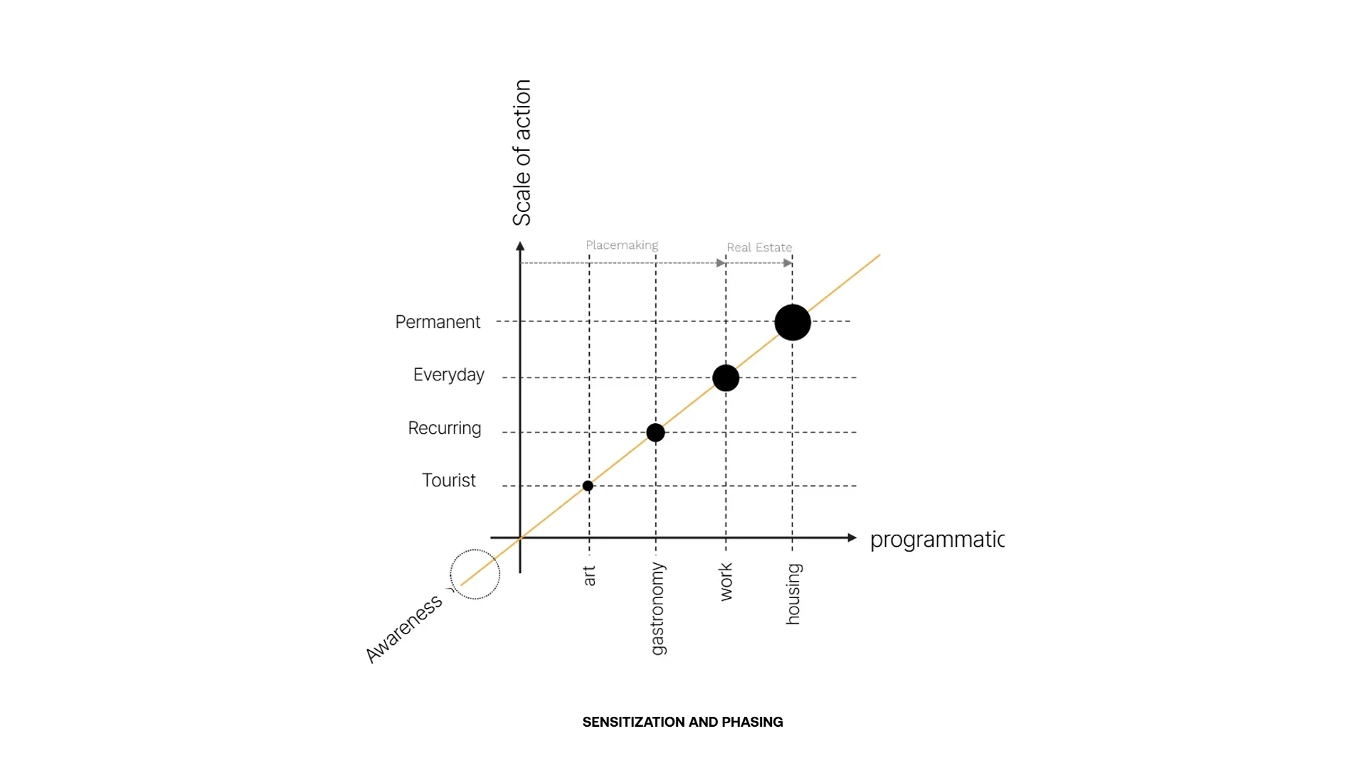
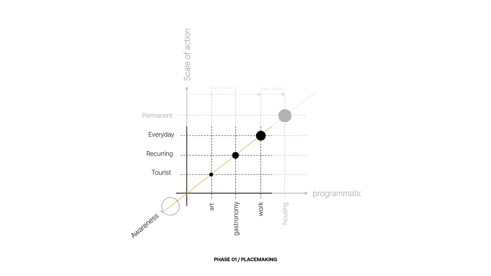
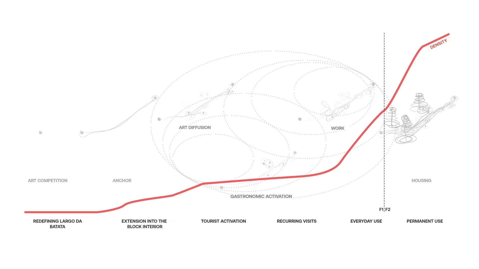
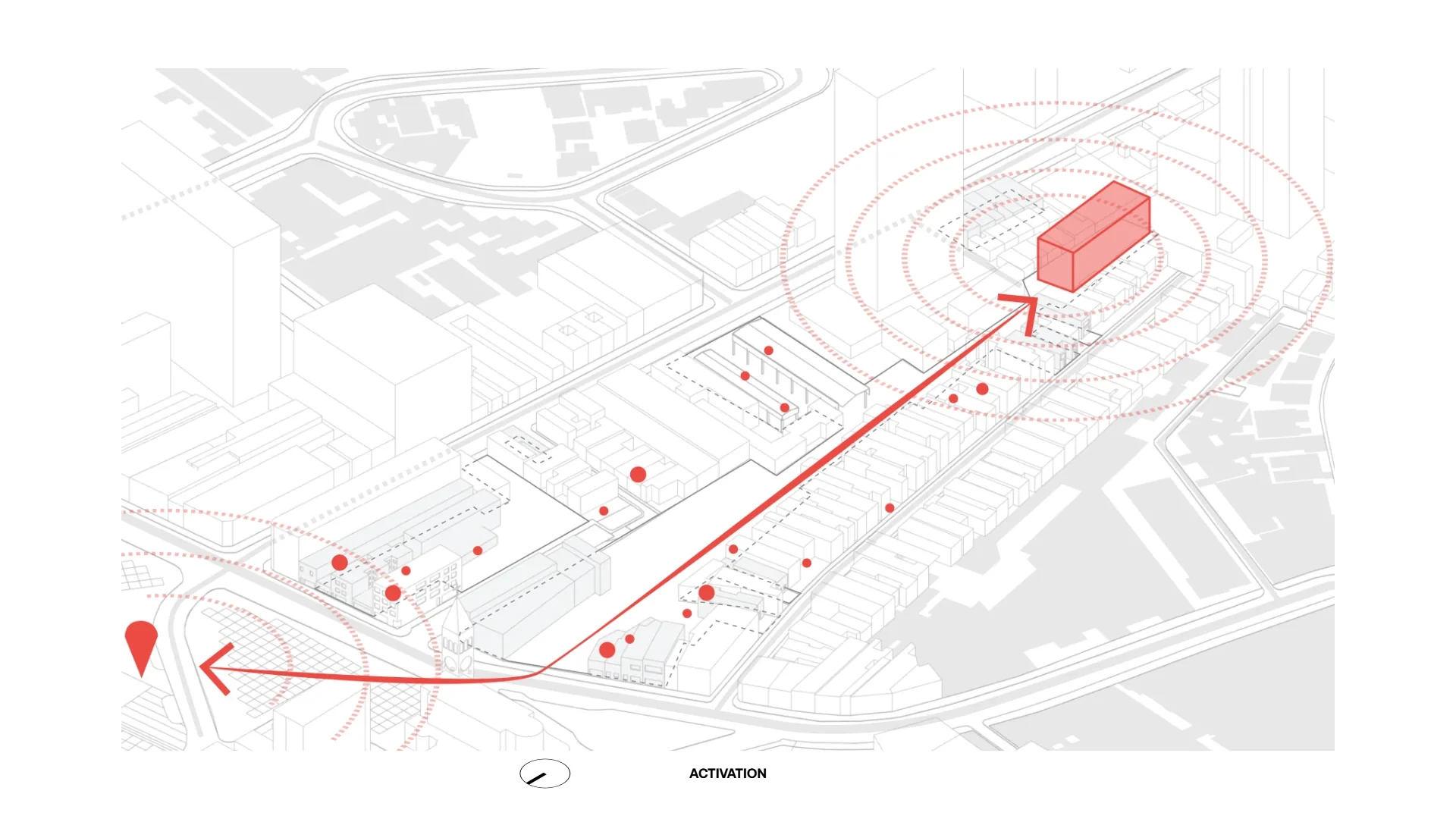
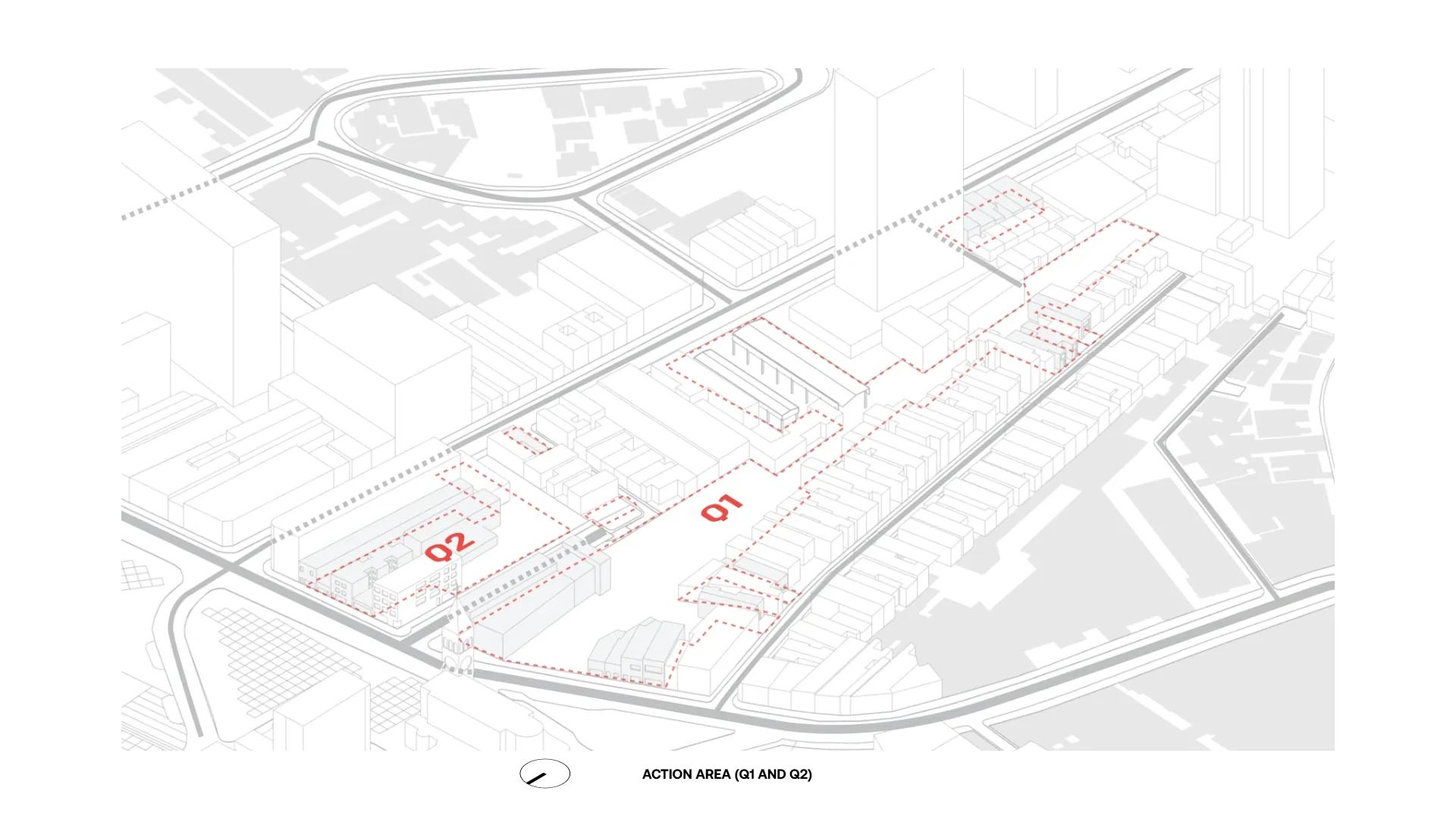
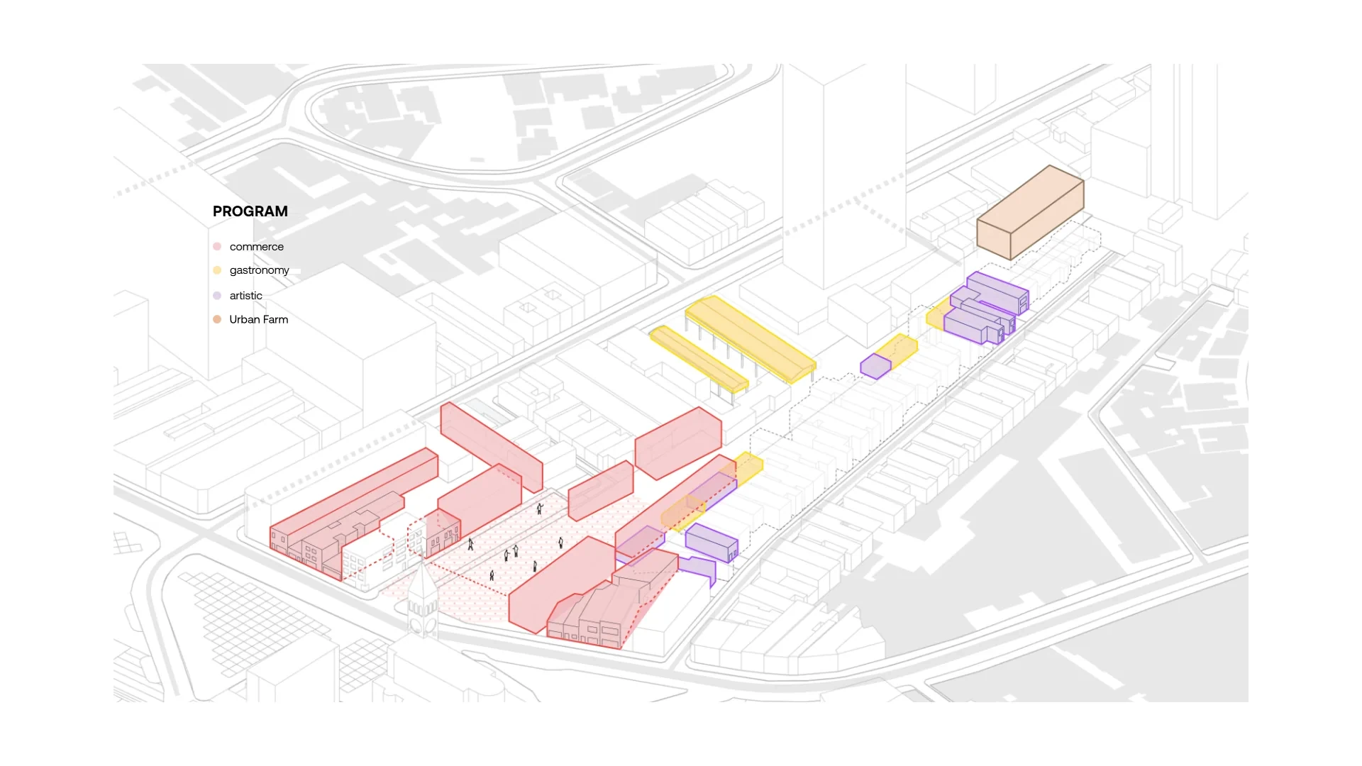
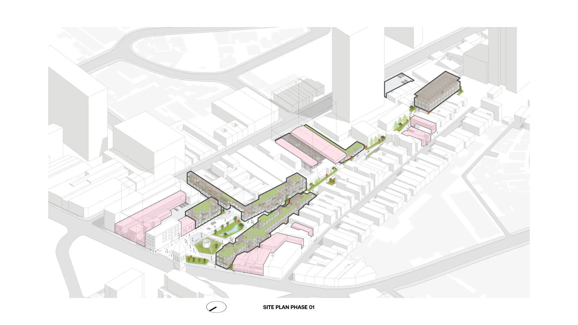
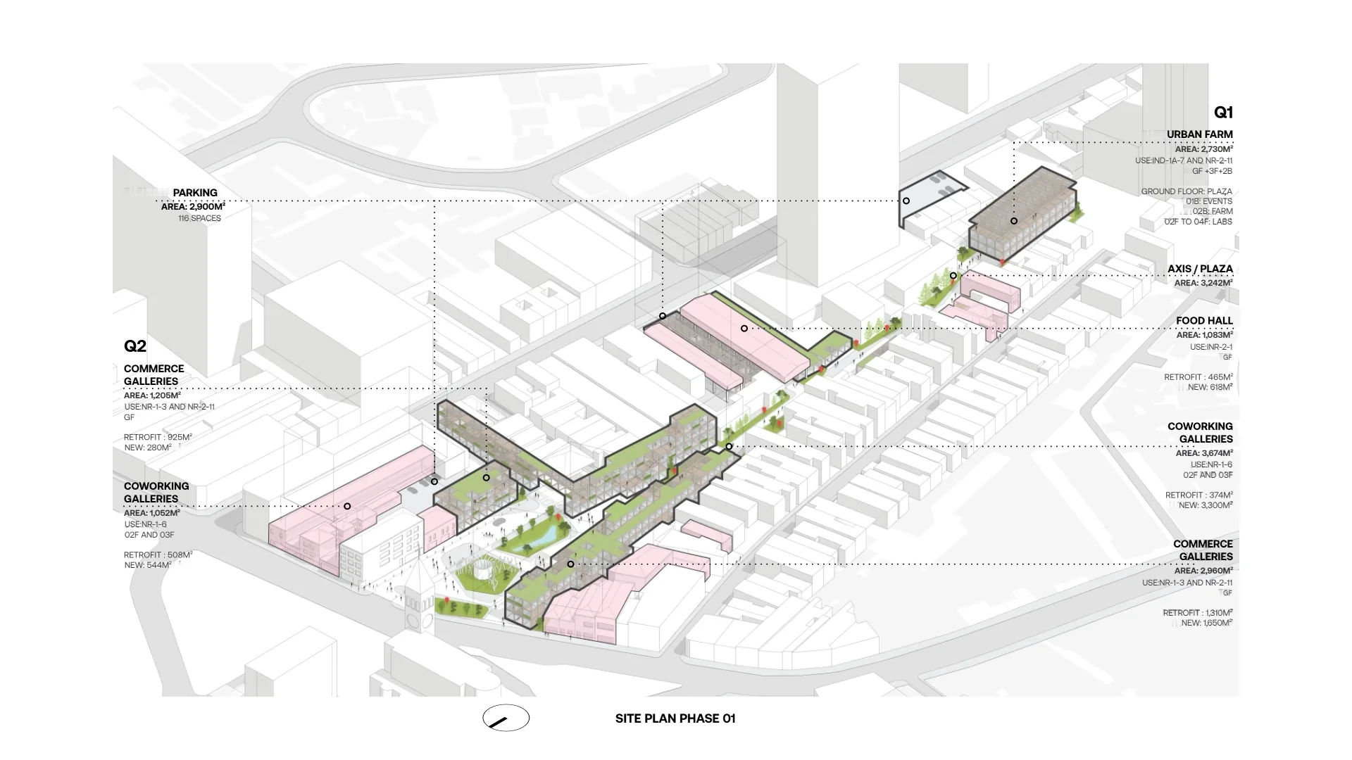
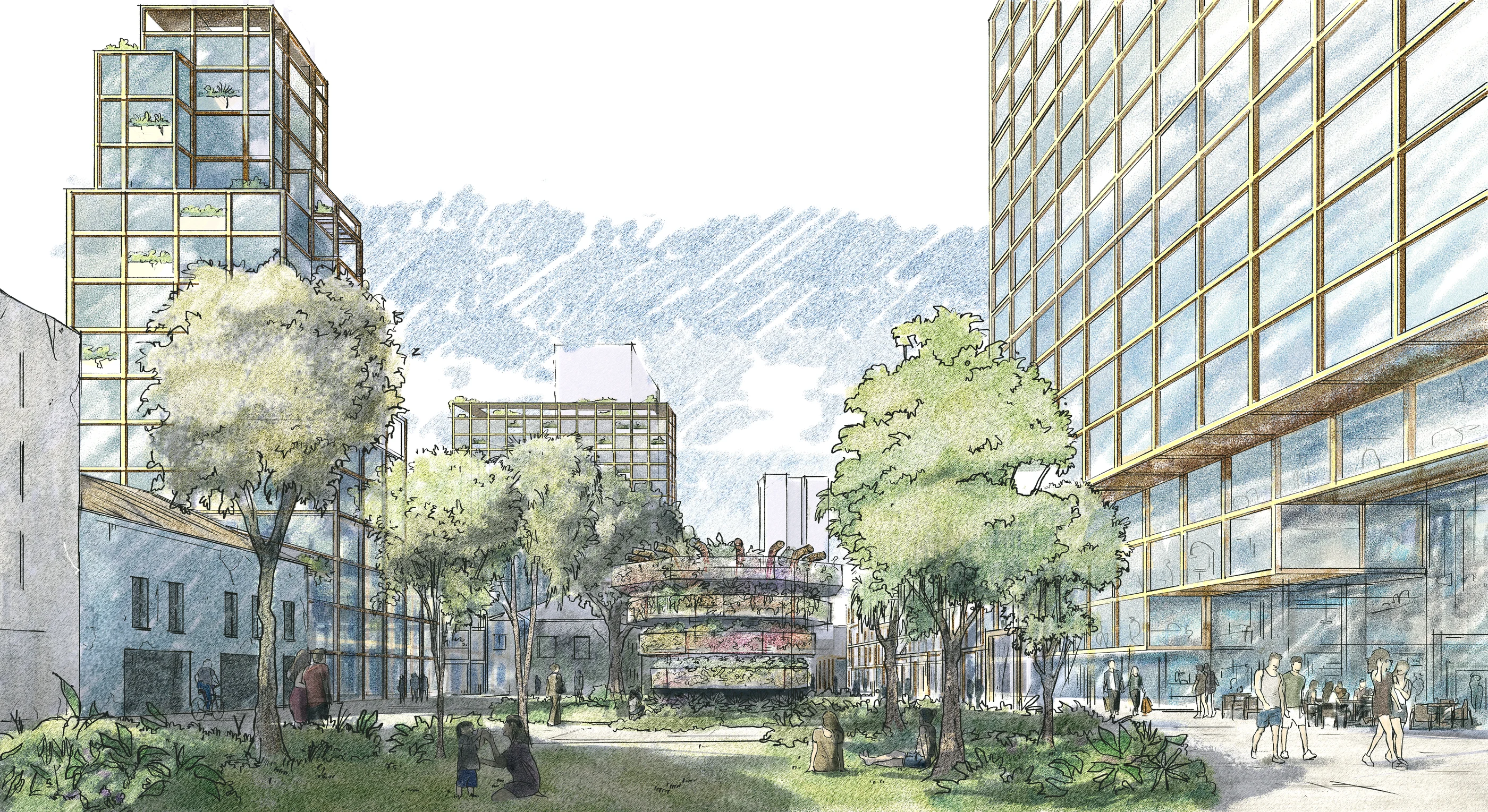
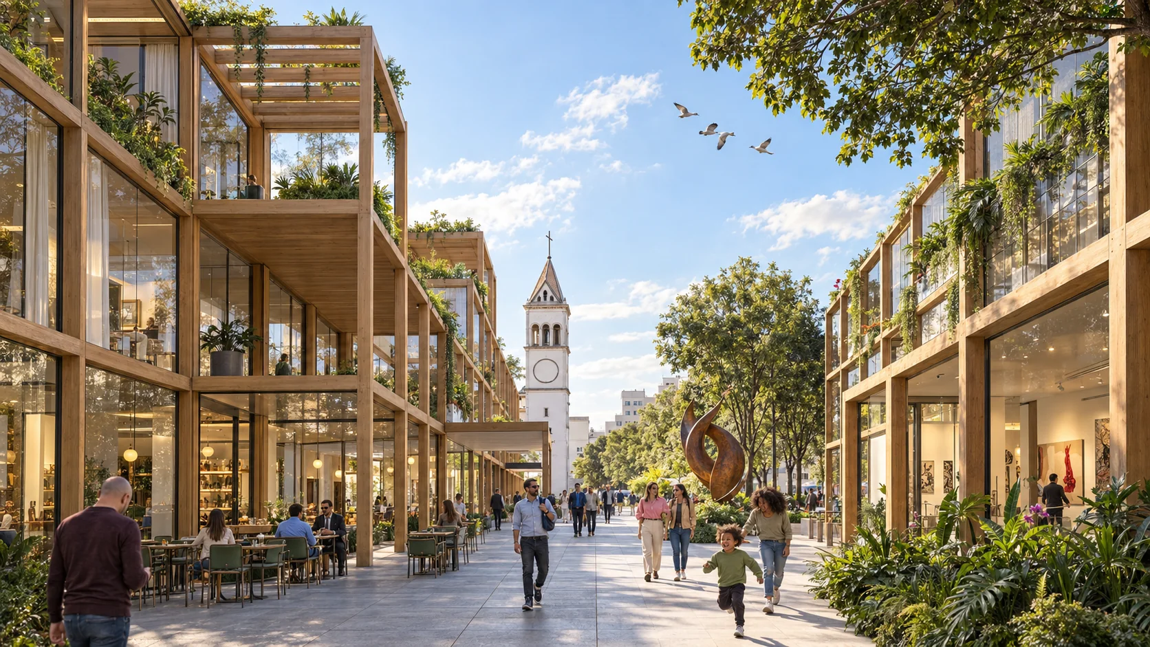
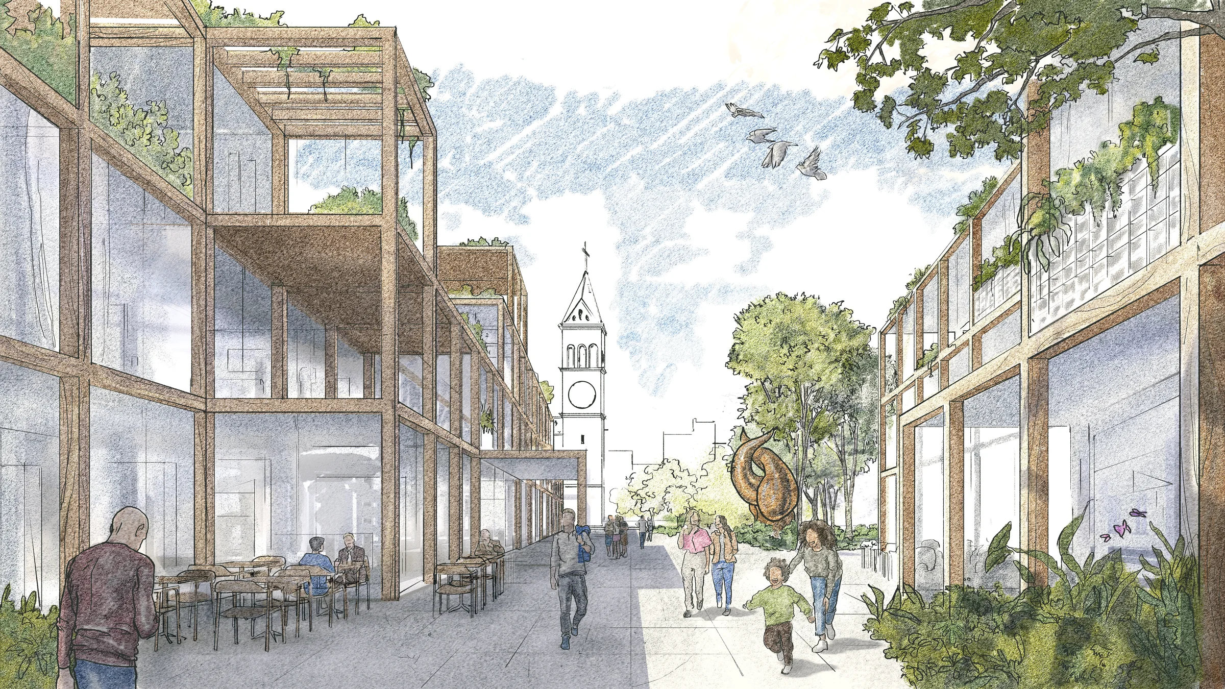
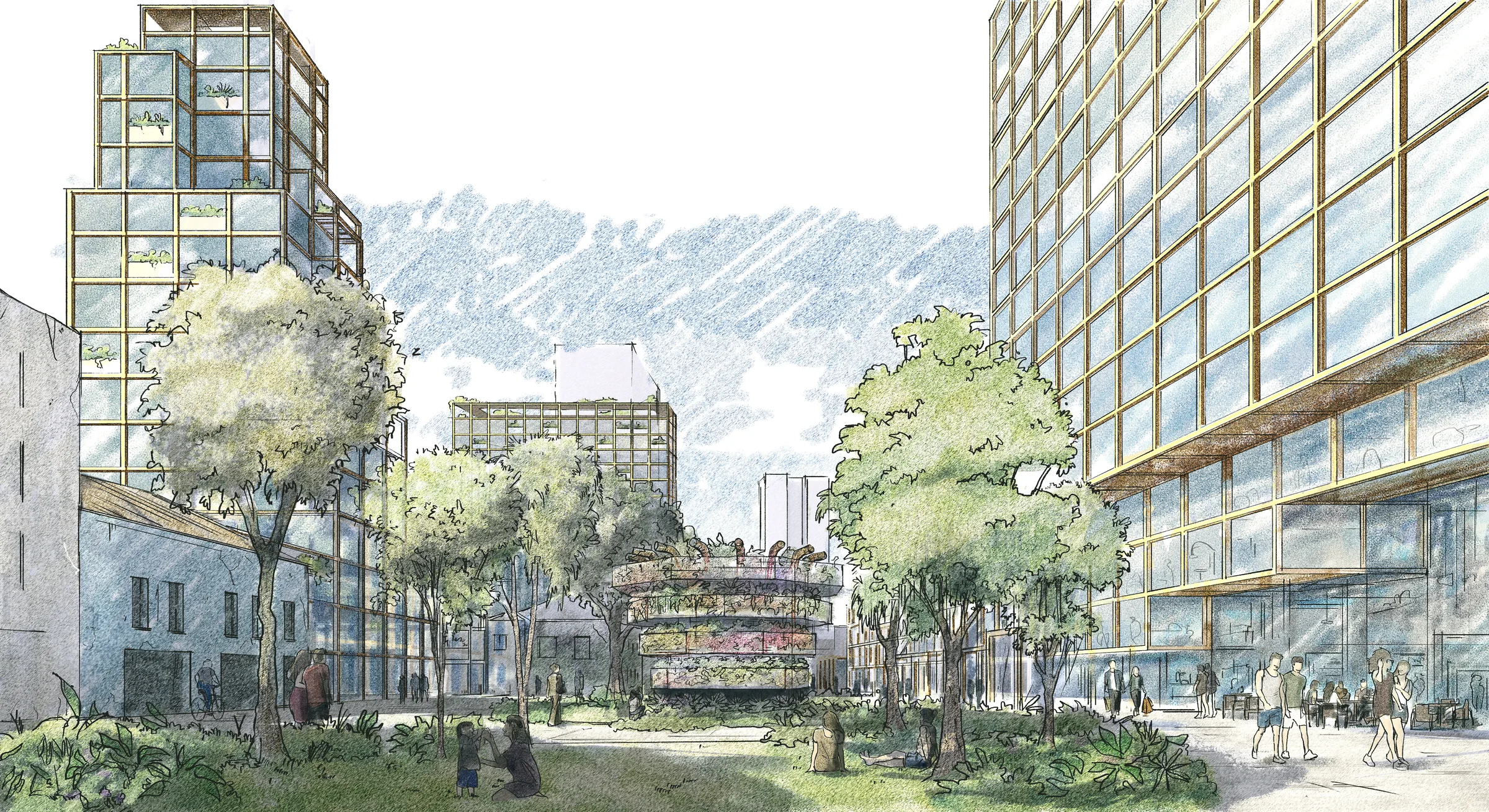
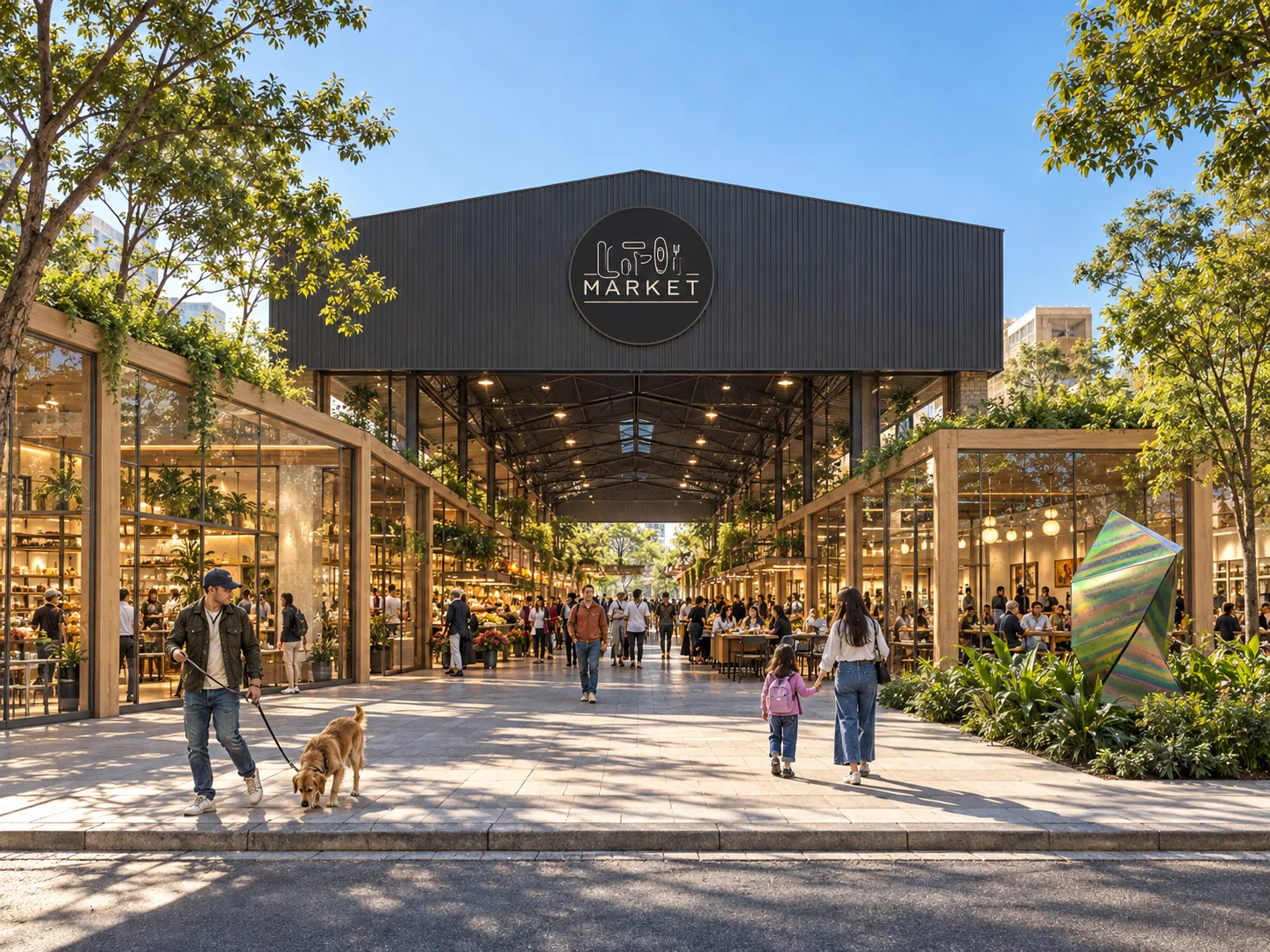
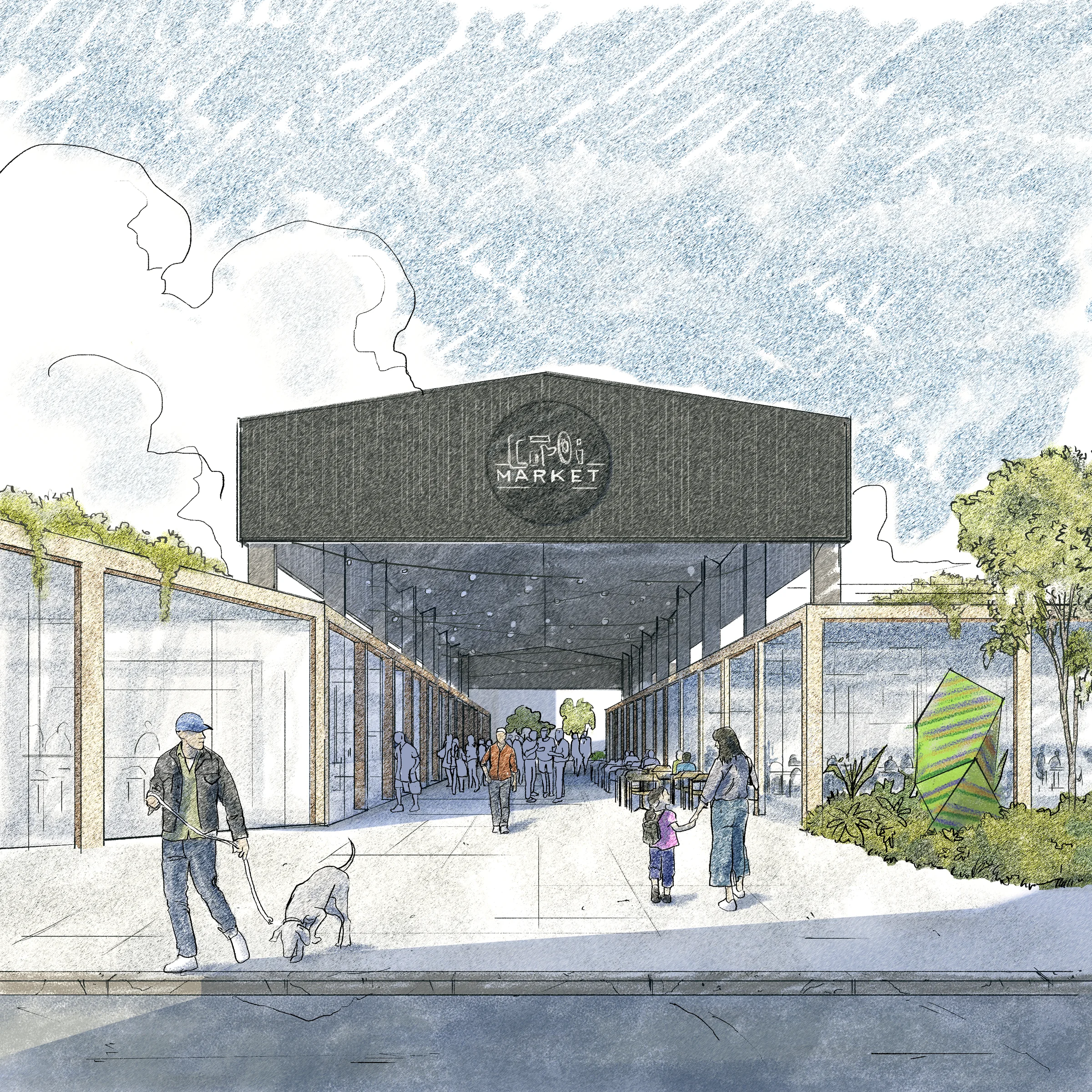
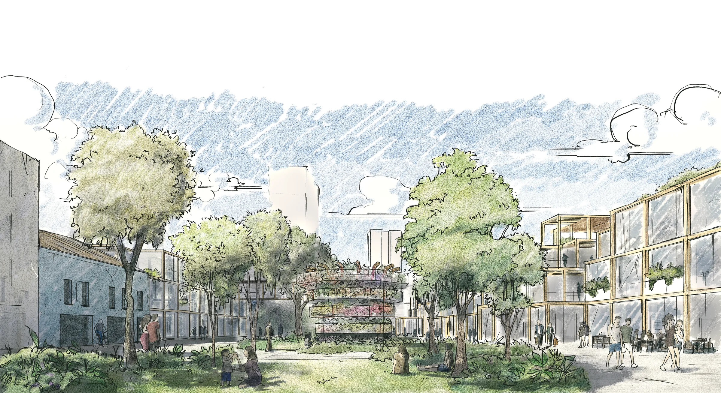
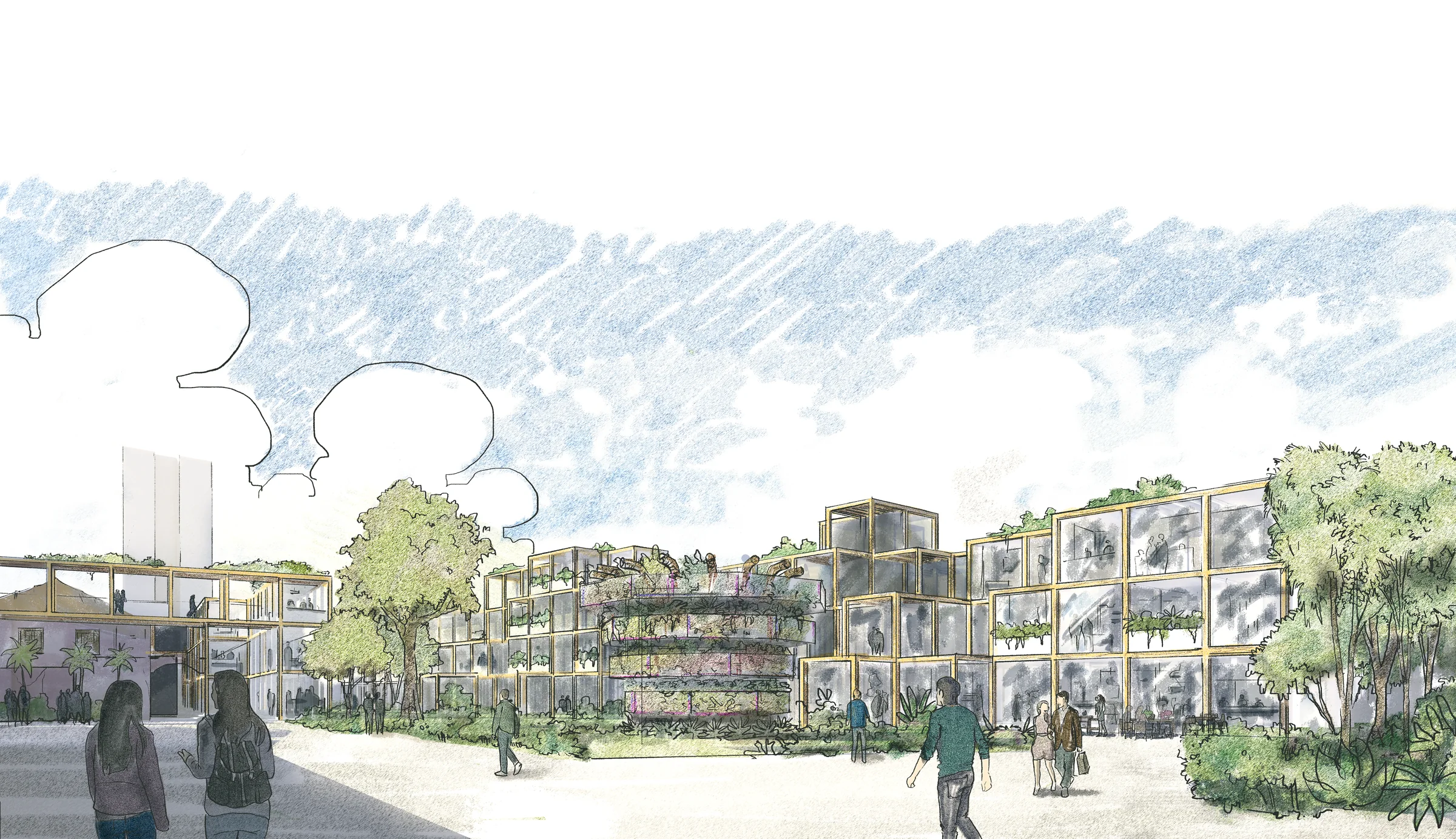
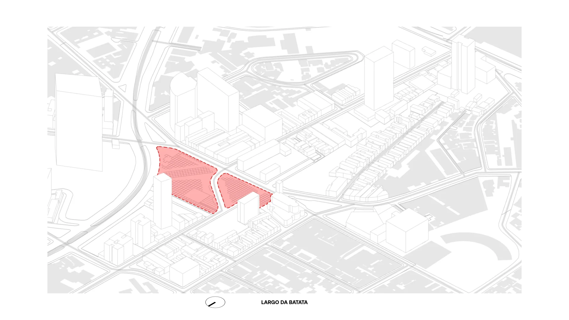
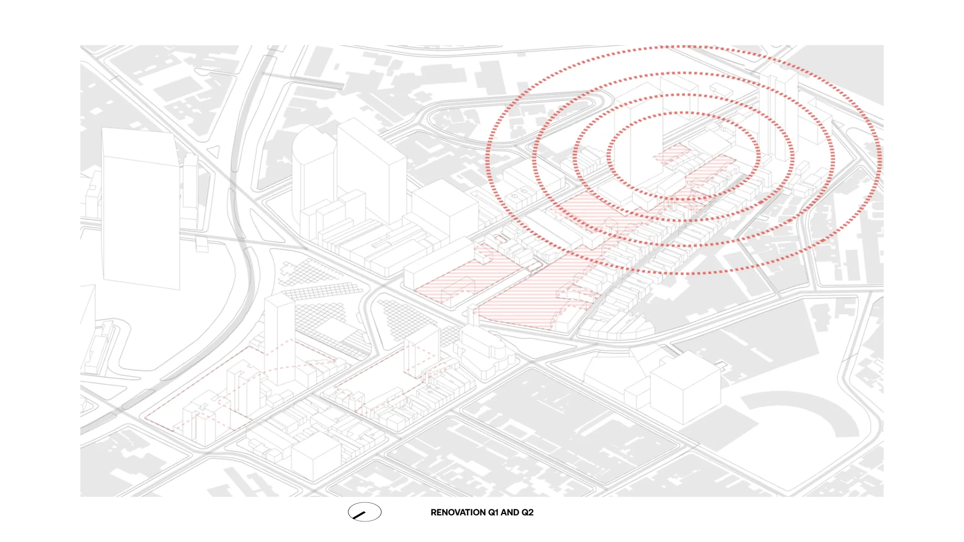
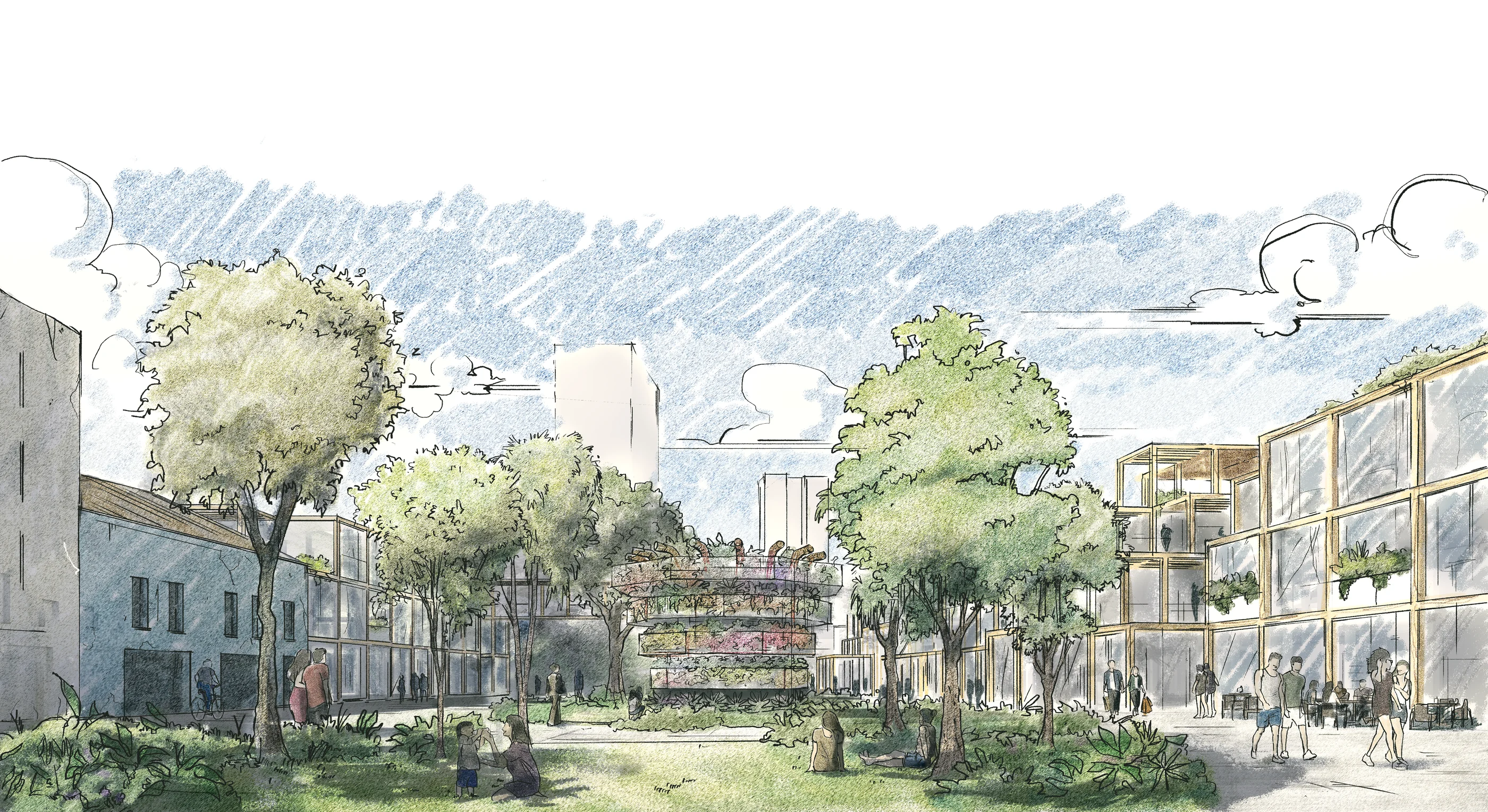
Phase 1 aims to raise awareness and spark interest in the site, creating a permanent dynamic of activation through a 3,242 m² public plaza that brings together uses focused on art, tourism, gastronomy and work.

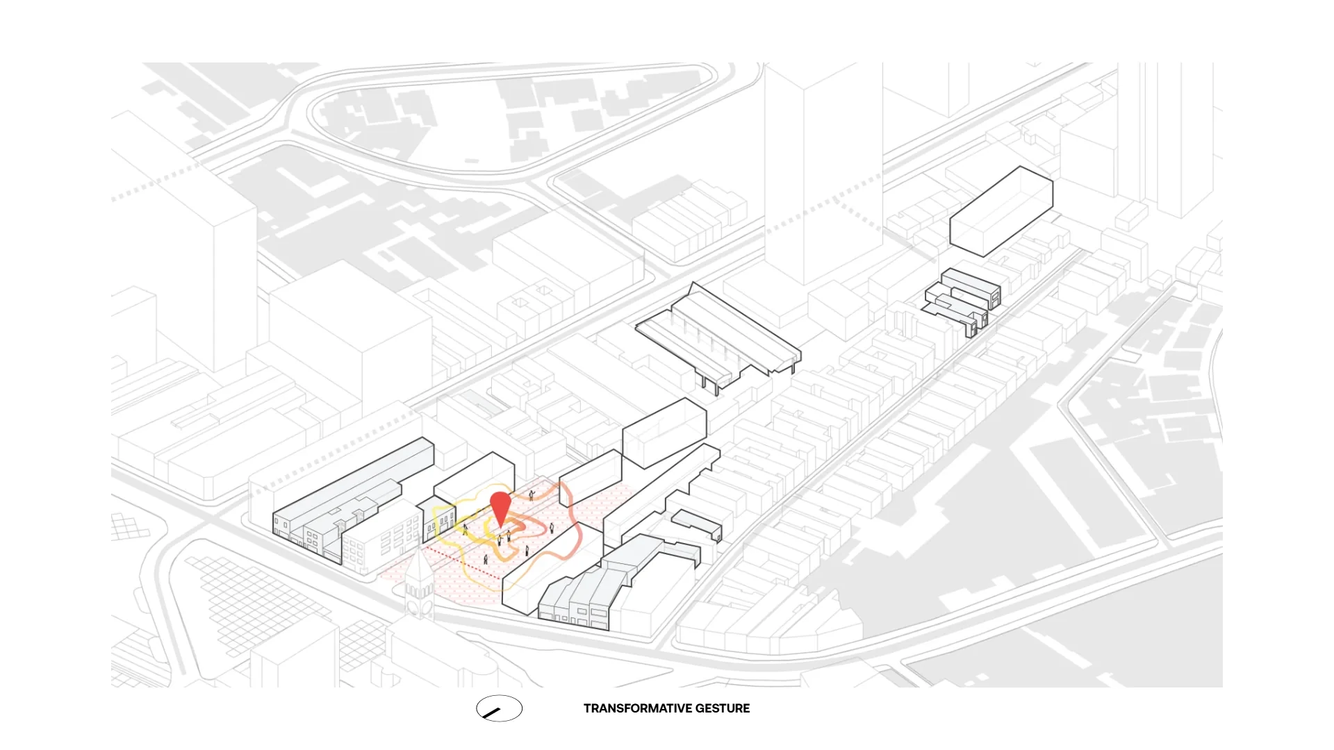
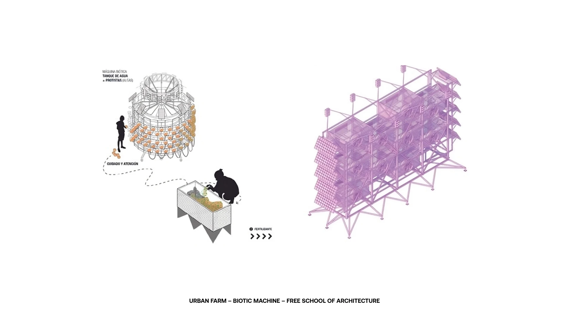
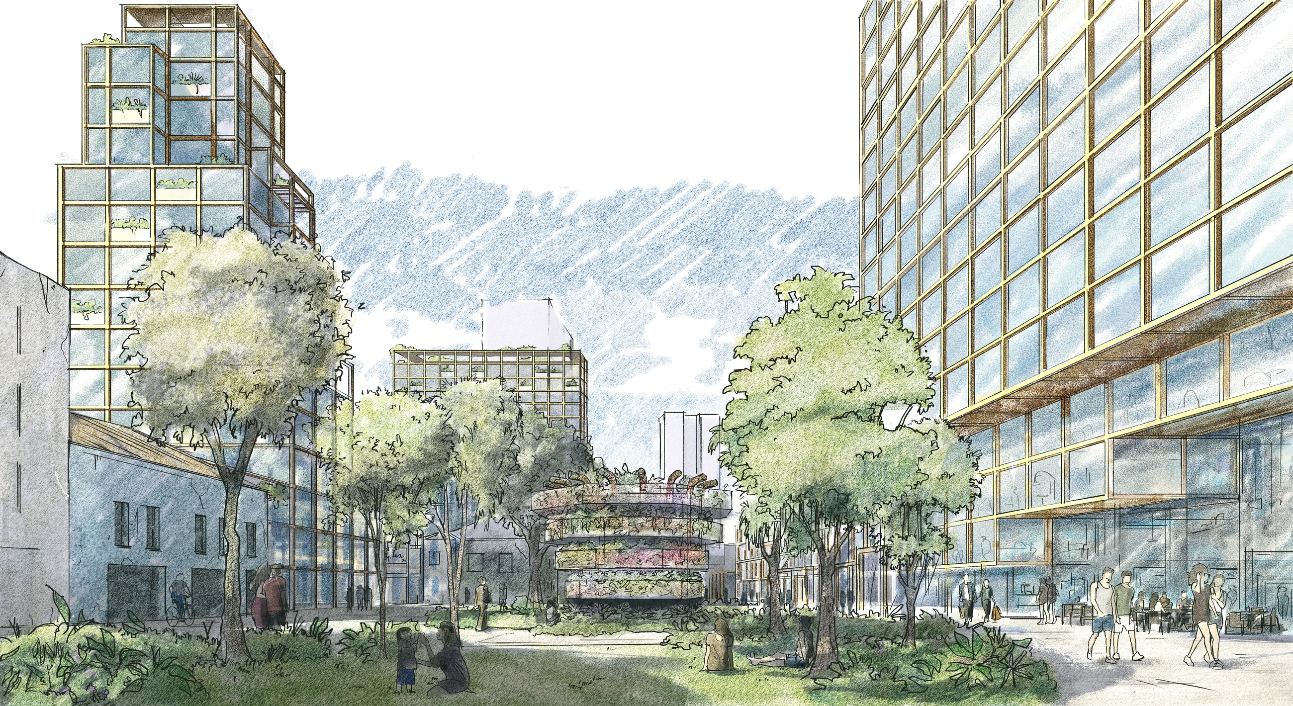
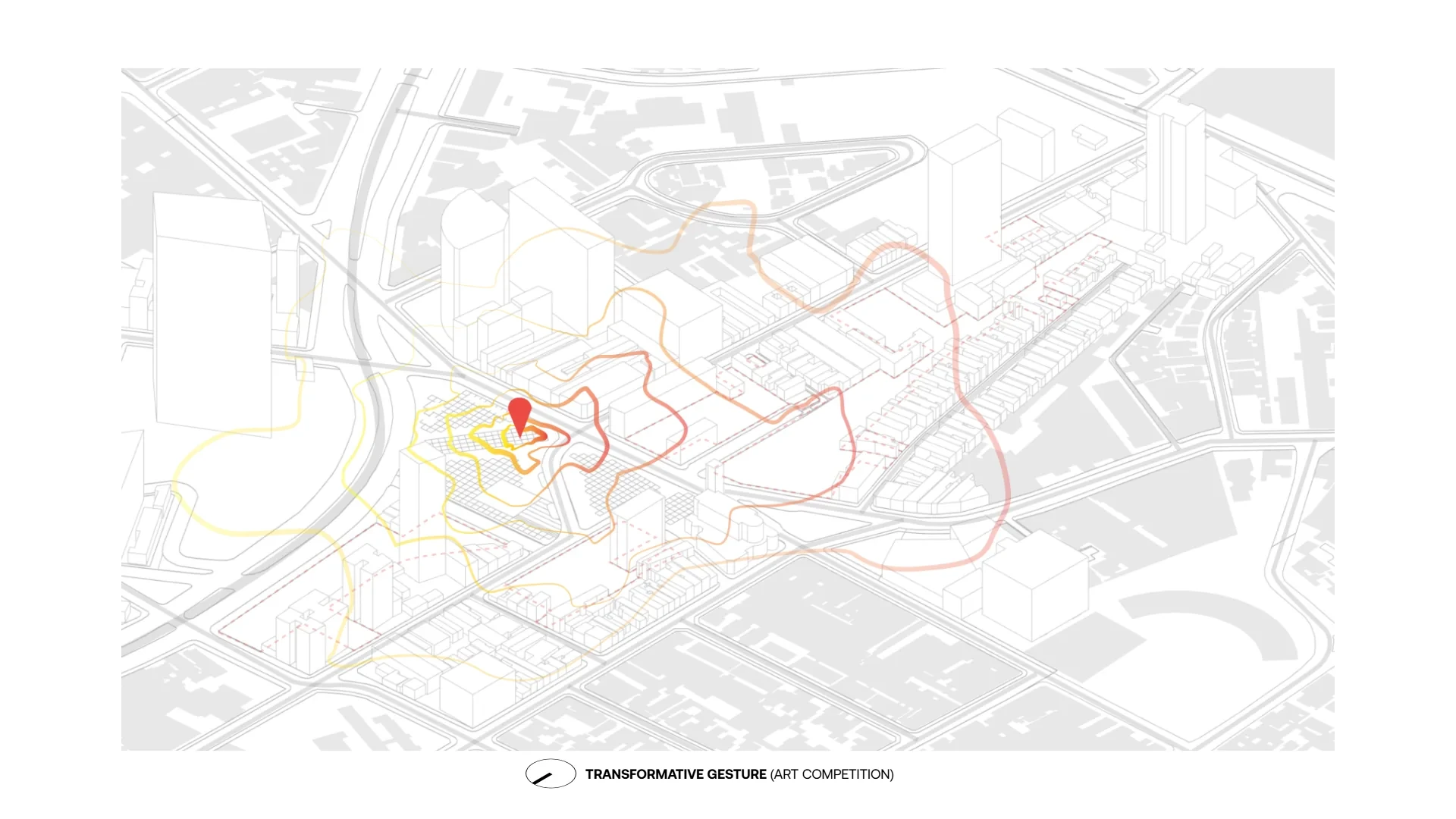
As a gesture of transformation, an urban art competition is proposed, inspired by the High Line, with a large-scale installation capable of drawing attention and signaling the transformations to come, and an urban farm tied to foodtech as the programmatic anchor, recovering the history of the Cooperativa Agrícola de Cotia, from 1920, through biotic machines for growing food.

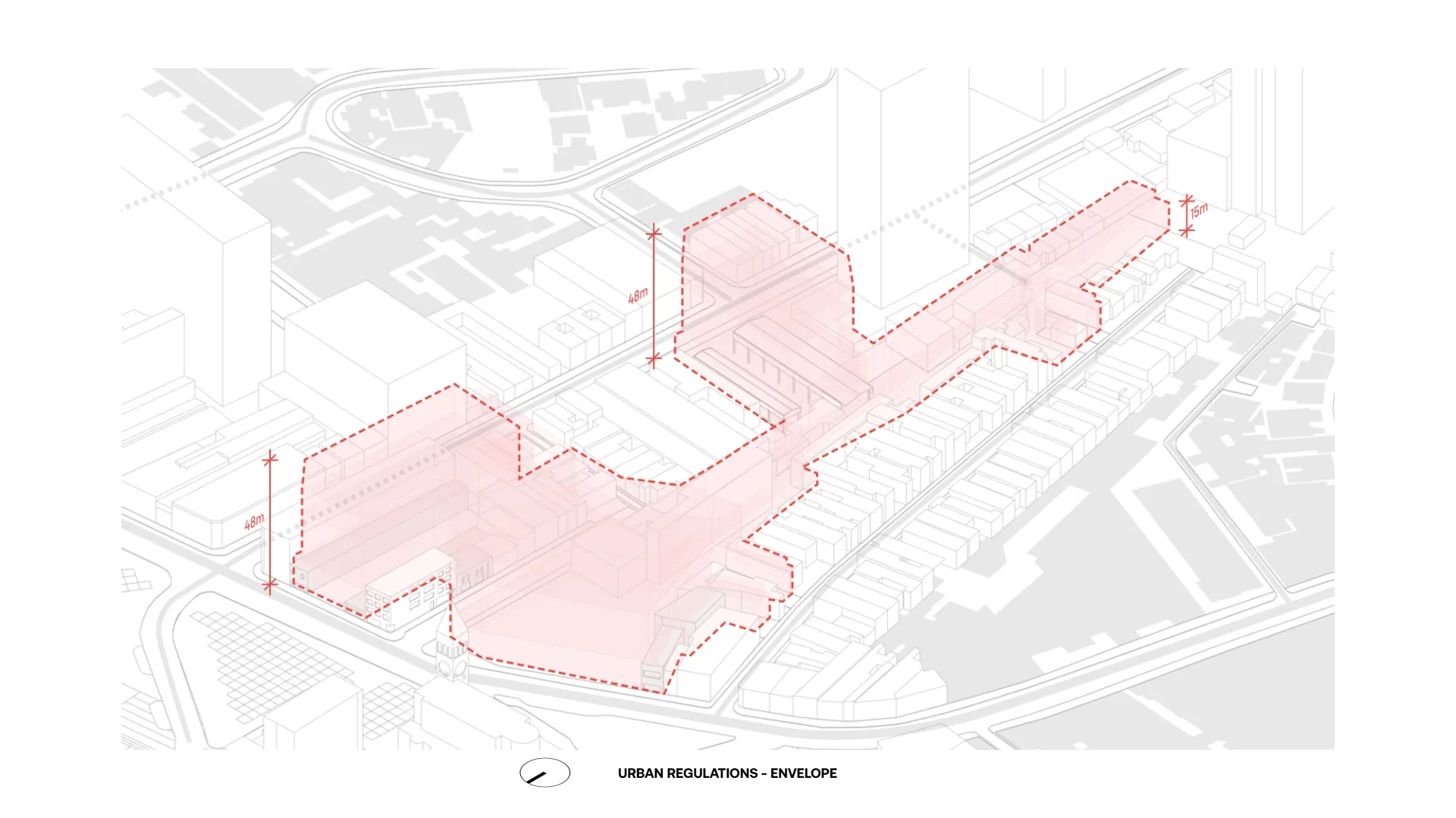
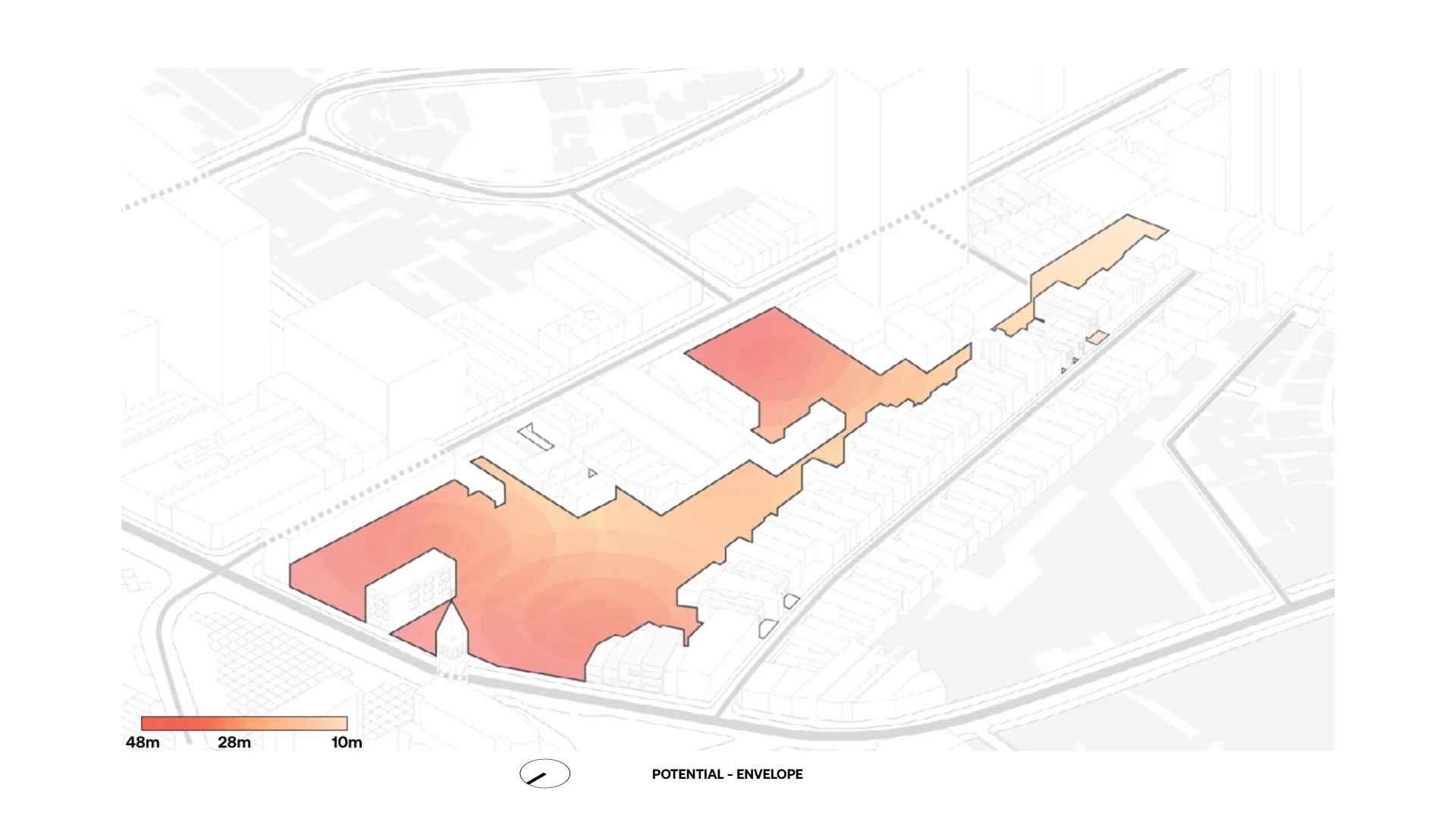
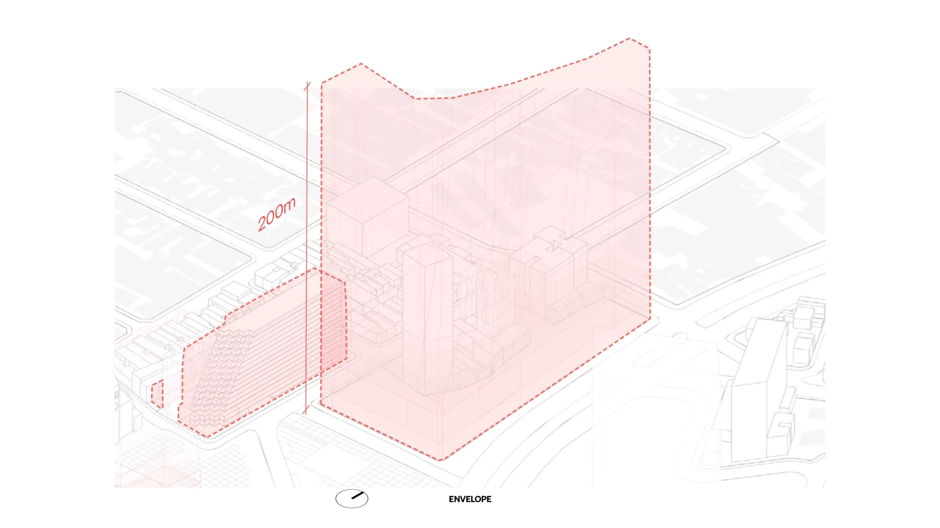
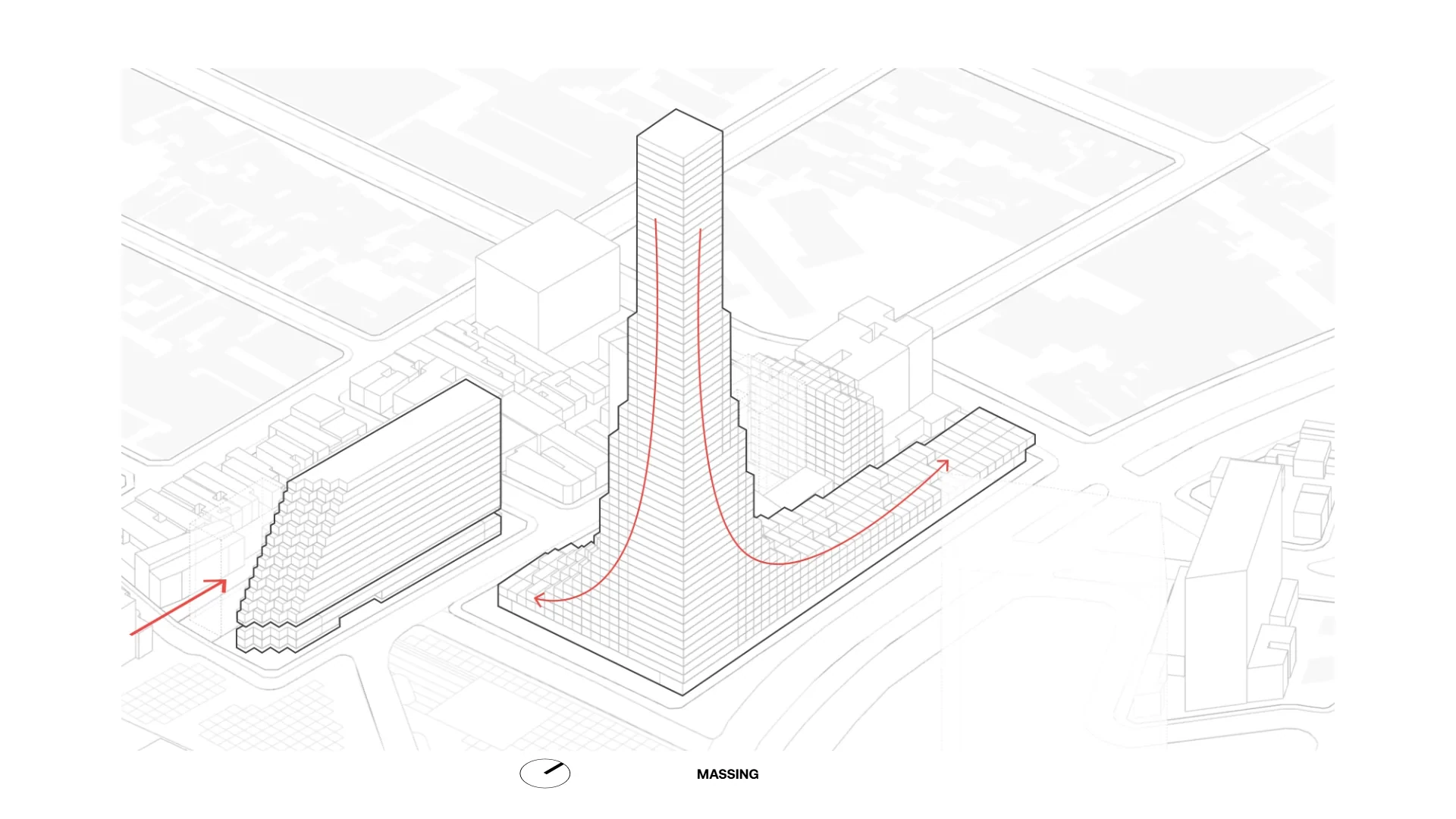
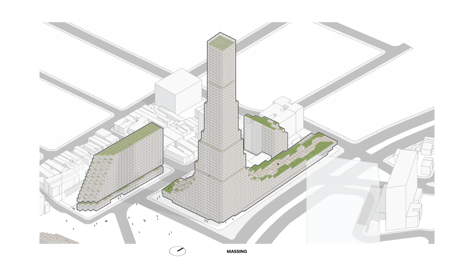
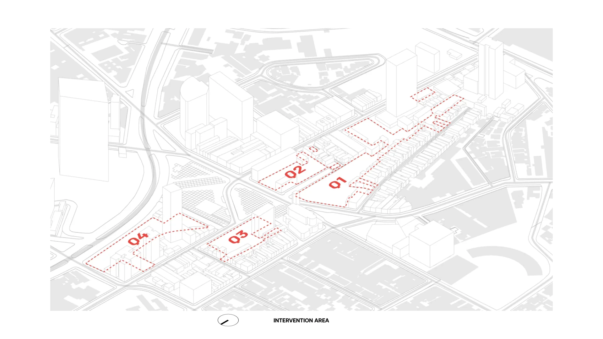
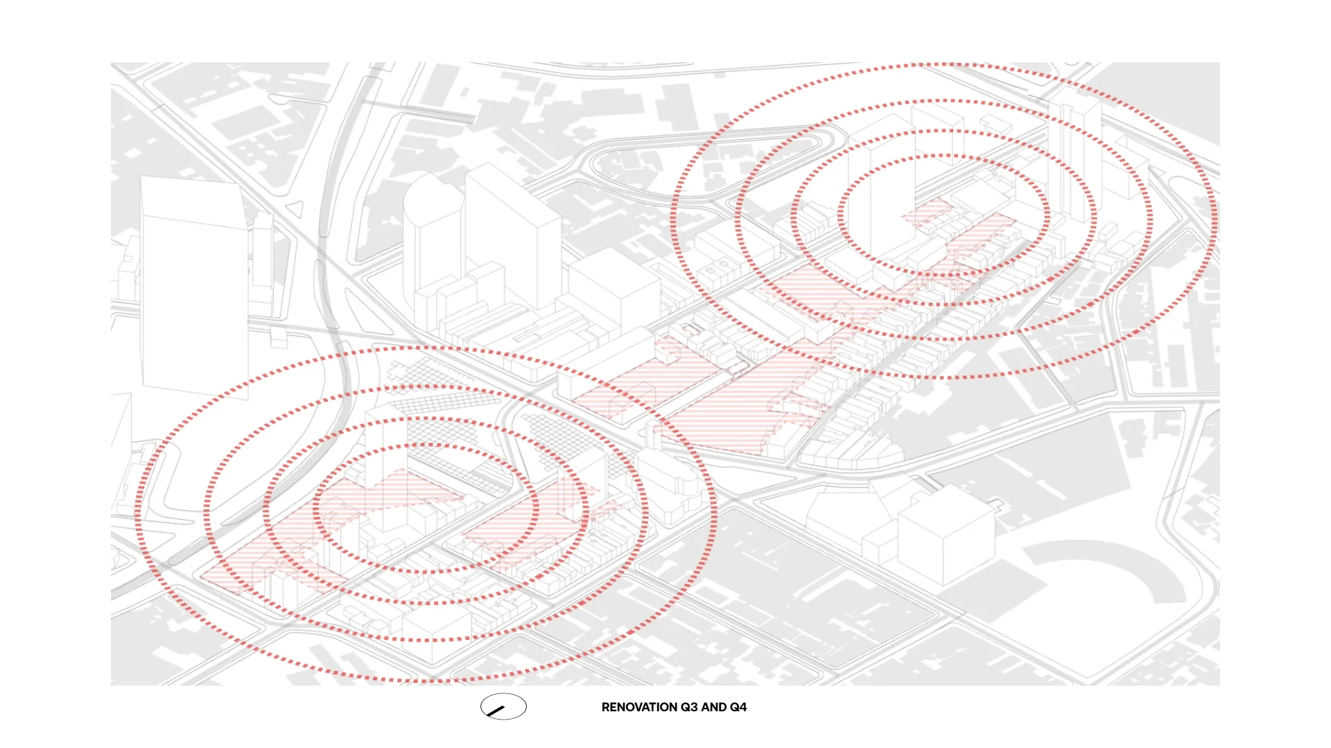
The implementation starts from a modular structure in engineered timber, as an alternative to concrete, allowing the project to consolidate over the years through the combination and verticalization of the modules, according to demand. The strategy preserves commercial activation at ground level while the complex grows, with 29% of the built area demountable and adaptable, while 71% remains for Phase 2.

Module

frame.adapt.compose.stack.

Real Estate

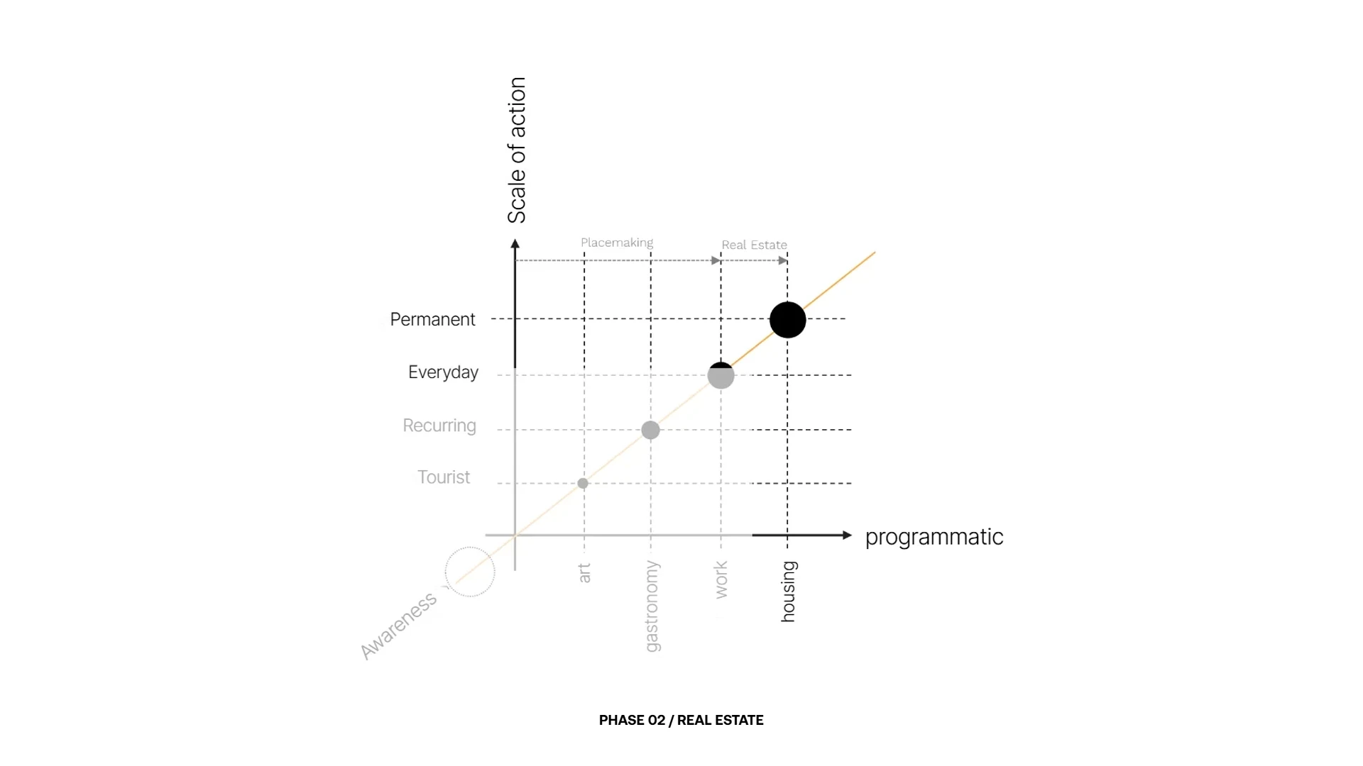
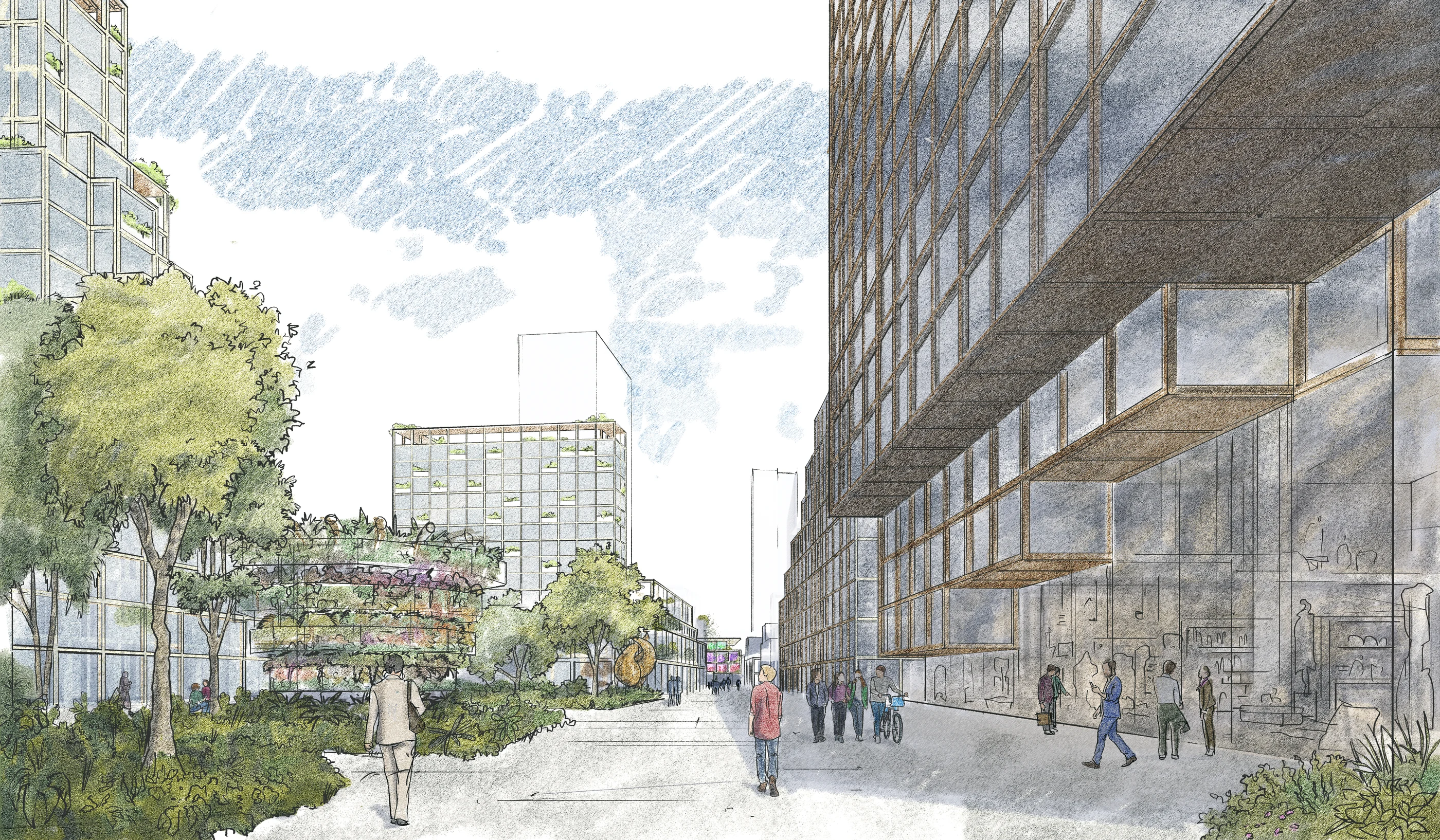
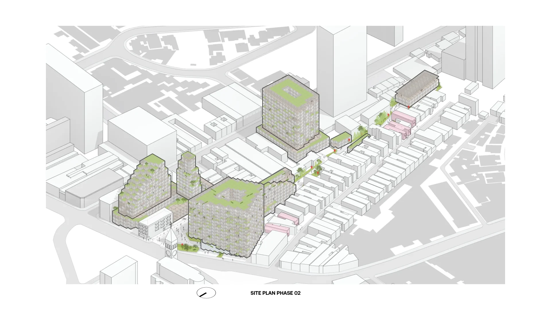
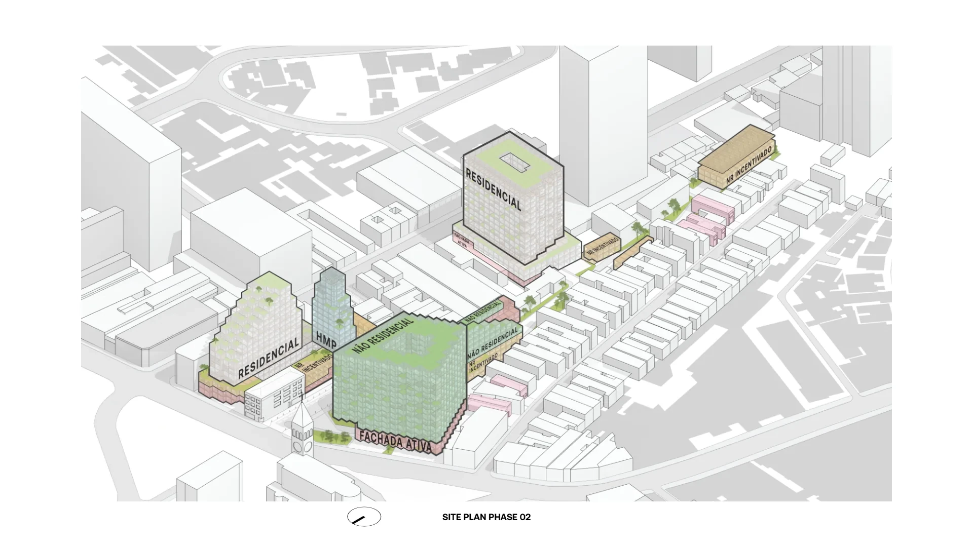
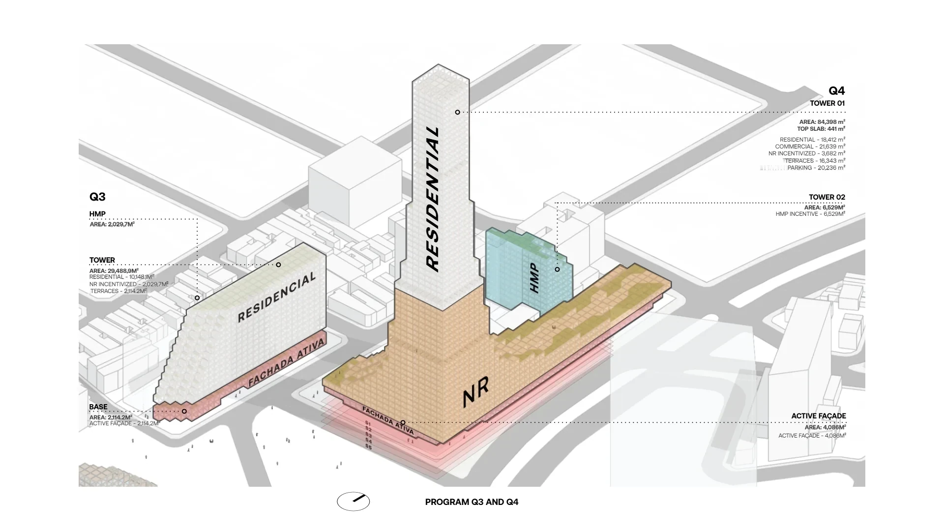
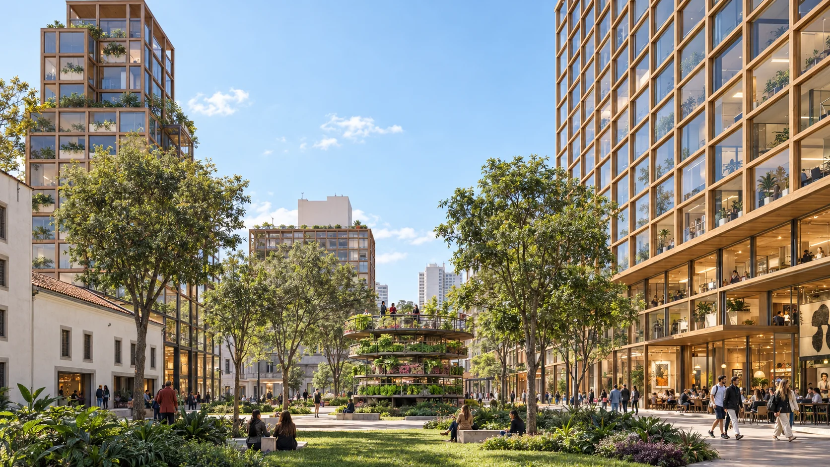
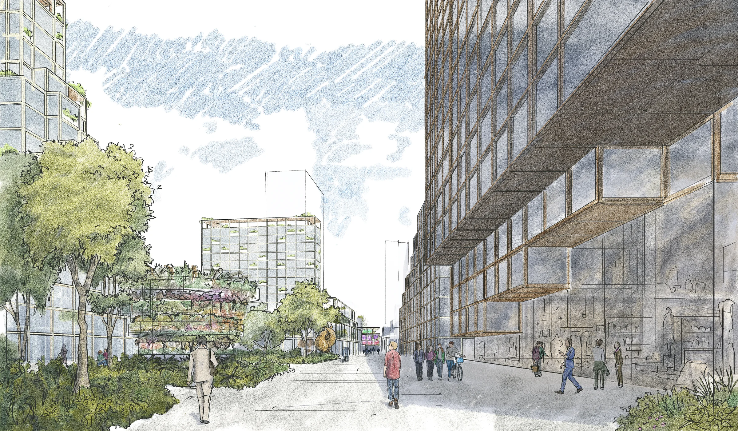
Phase 2 verticalizes the modules and introduces higher-density mixed use, combining housing, units for the local workforce, with coworking, galleries, food and active ground-floor uses, while façades, balconies and public interfaces reinforce street life and human-scale experience.
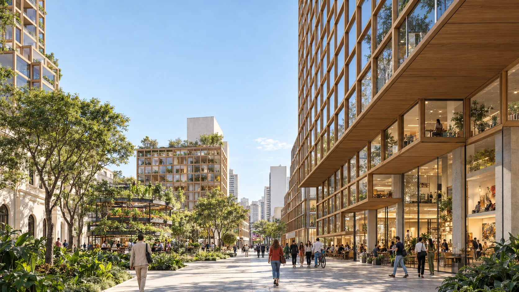
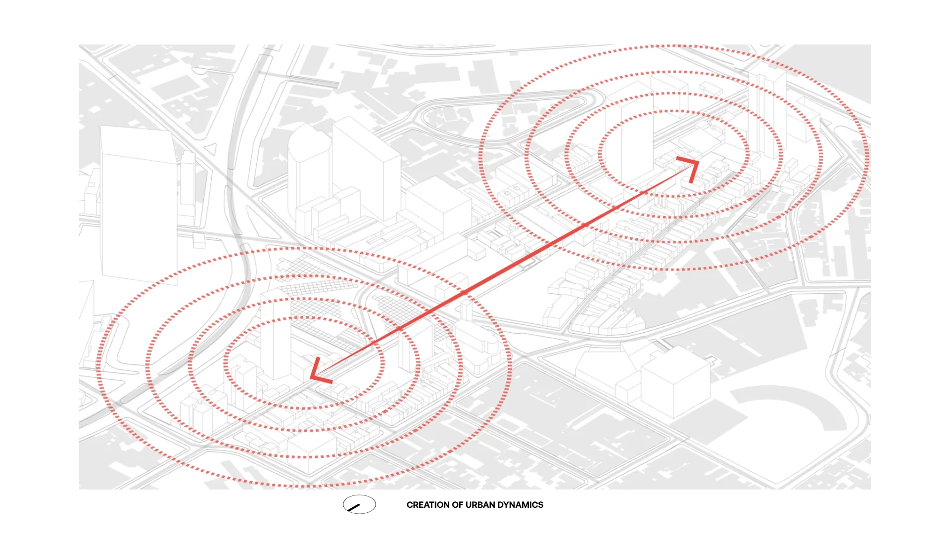
The complex evolves gradually, following the territory's new demands and consolidating an active, diverse urban centrality integrated with its surroundings.
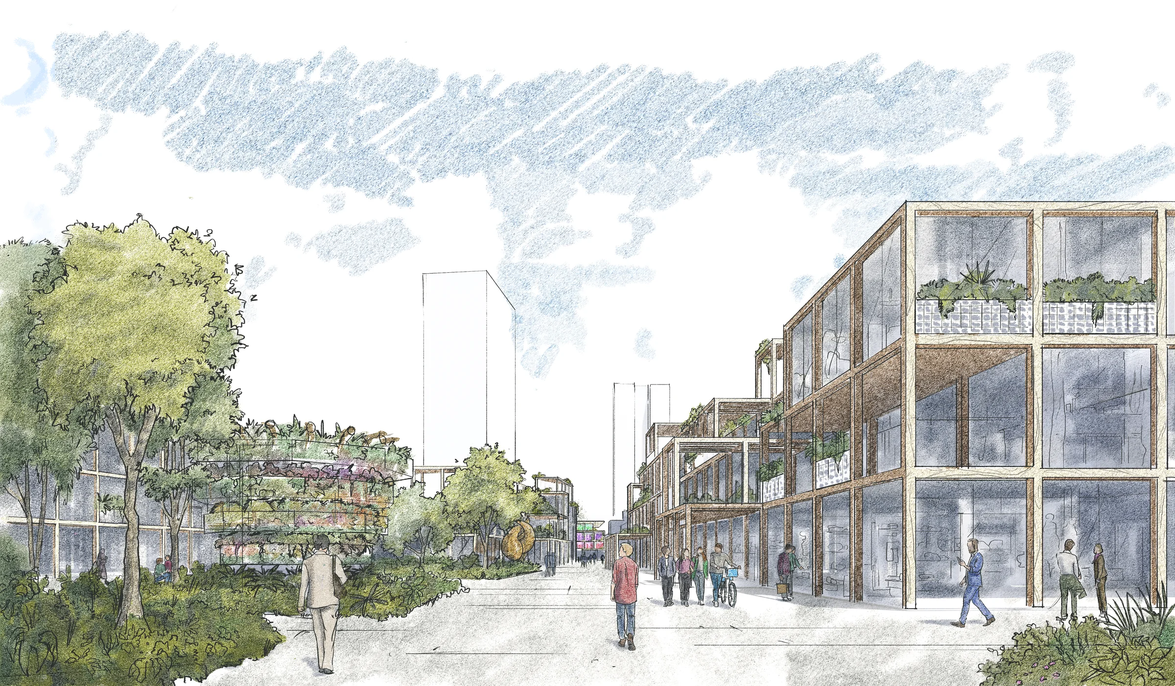
See more images of the project!

Info

DEVELOPER | Private
PROGRAM | Masterplan
LOCATION | São Paulo, SP, Brazil
STATUS | Concept design
YEAR | 2023
TOTAL BUILT AREA | 79,886.1 m²
SITE AREA | 25,195.75 m²

Team

PARTNER IN CHARGE | Rodrigo Milani
PROJECT LEAD | Henrique Clezar

SPECIALISTS | Cristiano Carneiro, Lucas Obino, Luciana Fonseca

ARCHITECTURE | Guilherme Fuhr, Henrique Clezar, Jean Zamarque,
Felipe Aguiar, Felipe Carneiro

Collaborators

ILLUSTRATIONS | Guilherme Silva

CONSULTING | Instituto Cidades Responsivas

Download